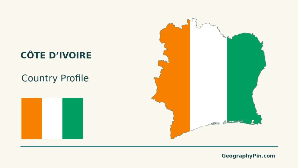
Côte d’Ivoire links an Atlantic lagoon coast with interior plateaus, western highlands and contrasting forest and savanna landscapes. Its best-known city and its national capital are not the same place, so a useful country map needs both Abidjan and Yamoussoukro.
Yamoussoukro is Côte d’Ivoire’s national capital, while Abidjan remains its principal economic centre and retains administrative functions. Yamoussoukro is inland; Abidjan lies beside the coastal lagoon system and major port facilities. A capital reference should preserve that distinction rather than replace one city with the other.
How to use this article: Compare the two city roles, read the physical settings, or explore the forest–savanna transition.
1. Locate the Country and Its Two Leading Cities
Five land neighbours and an Atlantic coast
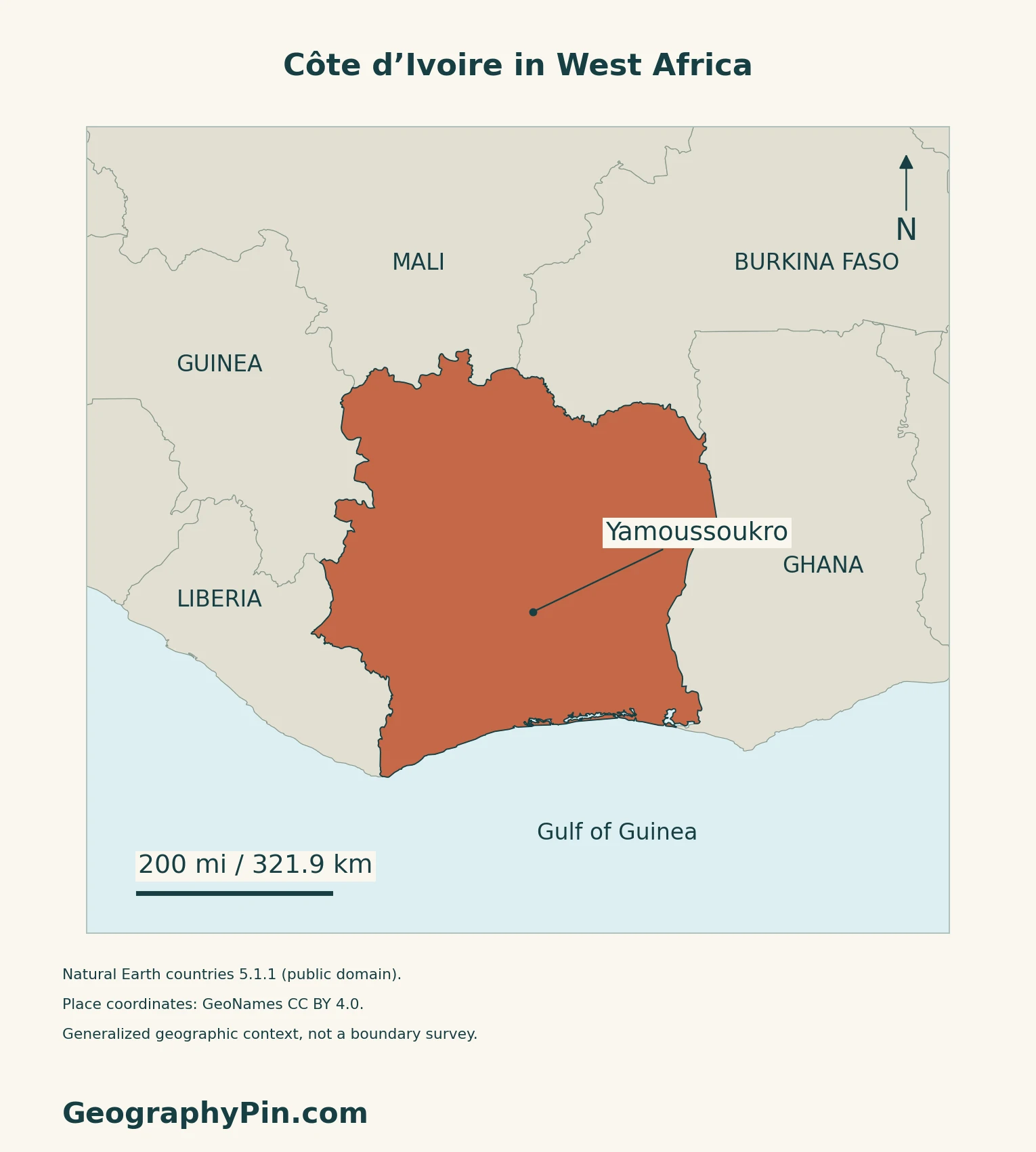
Côte d’Ivoire, also called Ivory Coast in English, lies in West Africa. Liberia and Guinea are to its west, Mali and Burkina Faso to its north, and Ghana to its east. Its southern shore faces the Atlantic Ocean in the Gulf of Guinea.
Yamoussoukro and Abidjan answer different questions
Yamoussoukro is the national capital inland. Abidjan, beside the coastal lagoon system, remains the leading economic centre and retains administrative functions.
The African capitals reference supplies the continental comparison; this profile focuses on how the two cities fit the country’s geography.
2. Compare the Coast, Plateaus and Western Highlands
Mostly low relief, with a more mountainous west
The Presidency’s geographical overview describes a country dominated by plains and plateaus, with more pronounced mountains in the west. The low-relief interior is not uniformly flat: valleys and local hills interrupt the wider plateau surface.
| Setting | Main distinction |
|---|---|
| Southern coast | Atlantic shore, including sandy barriers and lagoons in the east. |
| Interior plains and plateaus | Broad low-relief surfaces cut by river valleys. |
| Western highlands | More rugged terrain toward Guinea and Liberia. |
Abidjan’s port is connected to the lagoon
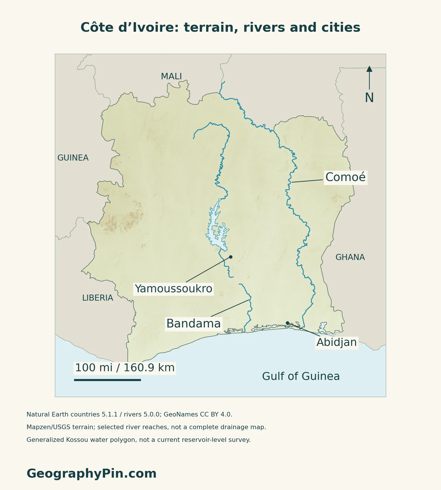
The Vridi Canal gives ships access to the port within the Ébrié lagoon. A Transport Ministry account of the canal’s 2019 enlargement explains the importance of these sheltered waters to Abidjan’s port development.
3. Read the Forest-to-Savanna Transition
A broad pattern, not an unbroken vegetation boundary
The country’s broad vegetation contrast runs from southern forest settings toward northern savannas. That description does not mean the whole south is still covered by intact forest or that all wooded habitats stop at one latitude.
Taï National Park in the southwest protects a major surviving part of West Africa’s primary tropical forest. UNESCO identifies its flora and threatened mammals as important conservation features. It provides a concrete forest example, rather than a template for every southern landscape.
In the northeast, Comoé National Park contains savannas, wooded savannas, gallery forests and other river-associated habitats. UNESCO explains that the Comoé River helps sustain vegetation normally associated with wetter places farther south. Forest and savanna can therefore meet as a mosaic within the same protected landscape.
4. Follow Rivers and Seasonal Rainfall
Bandama and Comoé are two different basin types
The 2026–2035 National Adaptation Plan classifies the Bandama among national river basins and the Comoé among transboundary basins. Its overview describes predominantly southward drainage toward the Atlantic, with the Niger basin an exception. The two labeled rivers on the map are selected examples, not the complete drainage network.
The southern and northern calendars differ
The same plan describes two rainy and two dry periods across much of the south, compared with one main rainy season and a longer dry season in the north. This is a broad climate distinction, not a fixed timetable for every locality.
5. Check Dated Country Facts
| Item | Reference |
|---|---|
| Capital | Yamoussoukro; Abidjan remains the economic hub and has administrative functions |
| Population reference | 29,389,150 residents; final 2021 census results |
| Surface area | About 124,503 sq mi (322,462 km²); UNData’s 2023 reference |
| Currency | West African CFA franc (XOF) |
| Official language | French, under Article 48 |
| Administrative framework | 14 autonomous districts and 31 regions; Interior Ministry, November 2026 |
A resident census total with a defined scope
The 2021 census counted people usually living in the country, not only Ivorian citizens. Field enumeration ran from November 8 to December 14. The July 2022 final results incorporated data processing and the post-census survey. This is a historical census reference, not a current population projection.
City, district and national totals are not interchangeable. The published tables distinguish Abidjan city from its larger autonomous district, and similarly label Yamoussoukro’s administrative units.
Legal language and administrative levels
The Constitution identifies French as the official language. It separately assigns the promotion and development of national languages to legislation; official status does not mean that everyone speaks only French.
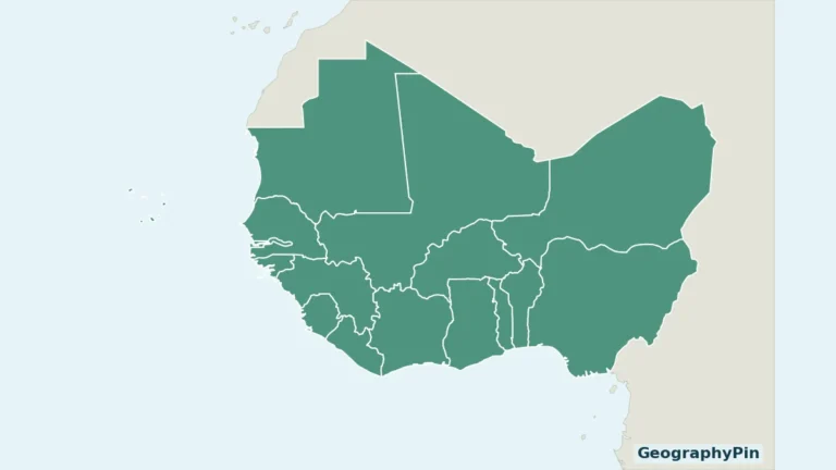
For the surrounding countries and regional context, see the West Africa country map.
What Did We Learn Today?
City roles, physical regions and river basins are different ways to read Côte d’Ivoire. Keeping them separate makes the capital distinction clearer and avoids treating the country as either one coastal metropolis or one uniform forest.
Sources & Data Notes
Sources, dates and map conventions
Population follows the final 2021 census tables and government methodology explanation, not an unverified newer estimate. The census reference uses the Ministry’s final tables and official release. Area is UNData’s 2023 surface reference. Language follows the Presidency’s consolidated Constitution incorporating the 2020 and 2023 amendments. Administrative counts are corroborated by the Interior Ministry on November 9, 2026; its electoral bill was still at committee stage. Physical-region labels are broad descriptions, not administrative boundaries or a current land-cover survey. The adaptation plan supplies climate and drainage context, not a weather forecast. The 2019 port account is used for the lagoon connection, not present traffic totals, rankings or navigation limits. No exact national summit elevation or river length is asserted.
- Ministry of Planning: original final 2021 census tables, July 2022
- Government open data: resident coverage and 2021 census field dates
- Ministry of Planning: July 7, 2022 final census and post-census survey explanation
- UNData: 2023 surface area, capital functions and XOF currency
- Presidency: consolidated Constitution, Articles 48 and 101
- Interior Ministry: November 9, 2026 administrative and electoral distinction
- Presidency: location and broad physical geography
- Côte d’Ivoire: first National Adaptation Plan 2026–2035, physical context and drainage
- UNESCO: Taï National Park forest setting
- UNESCO: Comoé National Park and transitional habitats
- Transport Ministry: February 2019 Vridi Canal enlargement account
Map method: Original maps use public-domain Natural Earth countries 5.1.1, rivers and lakes 5.0.0. The selected Bandama, Bandama Blanc and source-named Komoé reaches are drawn without invented joins; the display uses the spelling Comoé. Kossou is a generalized reservoir polygon, not a current shoreline or water level. City coordinates come from GeoNames under CC BY 4.0. Mapzen terrain retains Mapzen/USGS upstream credits. Negative southern coastal samples and one anomalous inland sample are withheld, not replaced; other heights are unchanged. Terrain shading is not a vegetation or climate map. Scales use local WGS84 distances. The cover uses Flagpedia’s explicitly reusable rendition, with orange at the hoist, white and green. Constitution Article 48 corroborates the equal vertical bands; 3:2 proportions are attributed to the rendition.