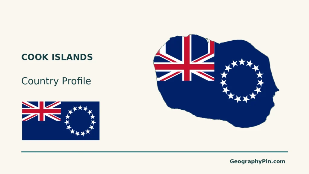
The Cook Islands are more than Rarotonga and its mountainous skyline: their northern and southern groups bring together widely scattered islands with different landscapes. A map of one island cannot show the reach of the whole country, just as a New Zealand connection does not fully explain its political status. Understanding both distinctions makes its geography easier to read.
The Cook Islands is a self-governing state in free association with New Zealand, not simply another name for Rarotonga. Its fifteen islands form northern and southern groups in the South Pacific. Avarua is on Rarotonga, while the wider country includes low coral settings as well as islands with volcanic and raised-limestone terrain.
How to use this article: Clarify free association, locate the island groups, or compare water-source settings.
1. Locate the State and Its Island Groups
Free association is a specific relationship
The Cook Islands lies between American Samoa and French Polynesia. It conducts its own affairs and international relations. New Zealand’s Ministry of Foreign Affairs and Trade describes it as a self-governing state in free association, sharing the Realm’s head of state and holding its own international legal personality.
That status is not the same as UN membership. The Oceania capitals reference deliberately covers UN member states, so its fourteen-country selection does not include the Cook Islands.
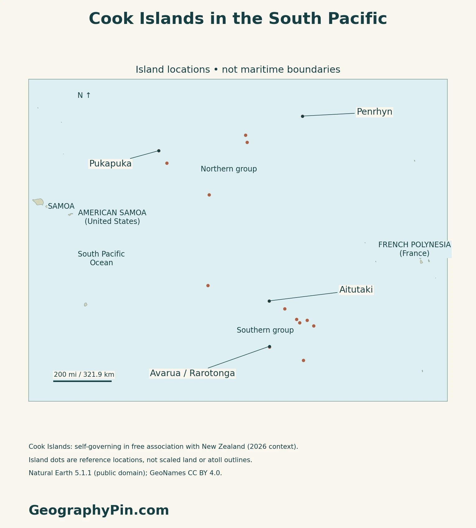
Six northern islands and nine southern islands
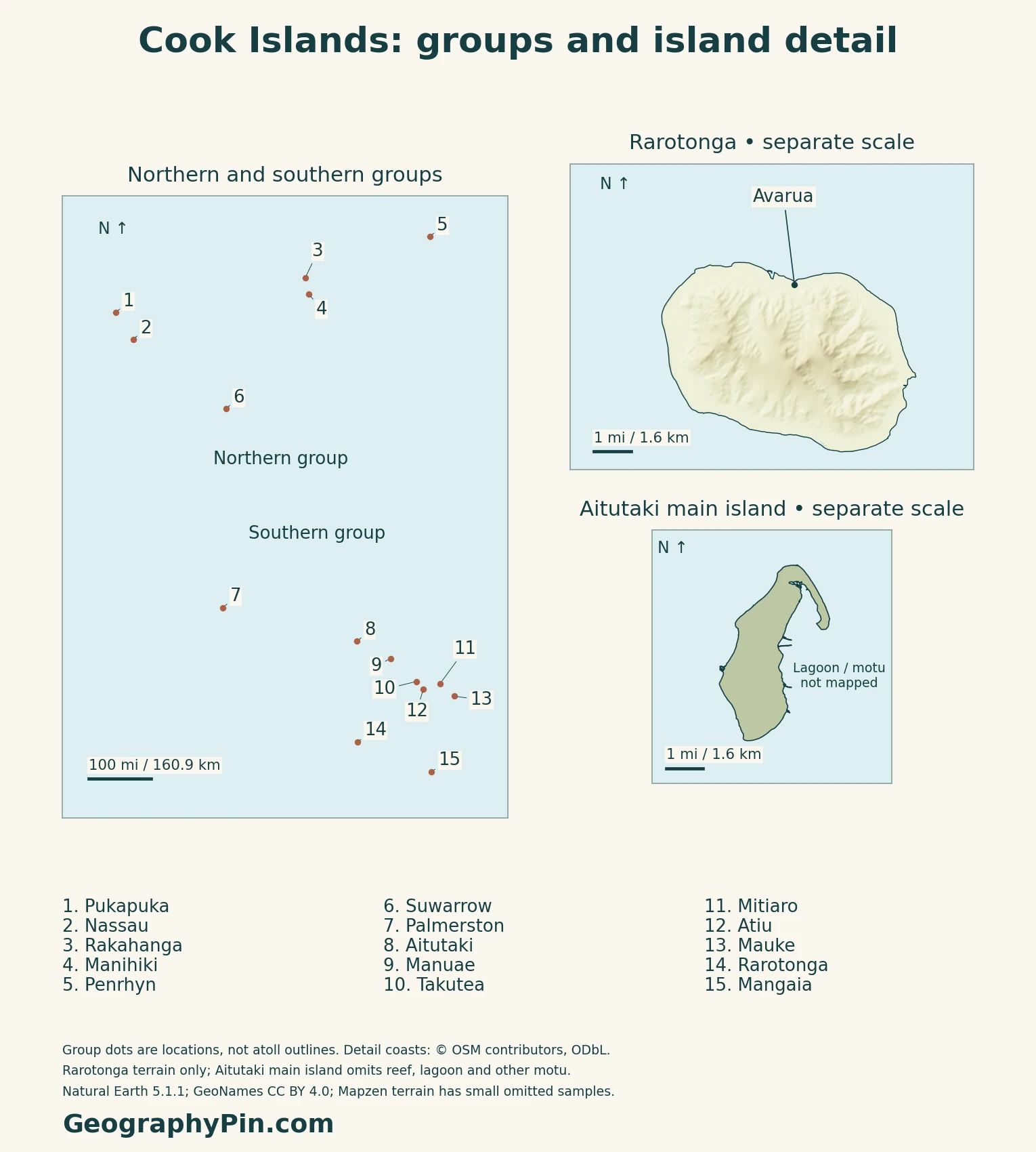
The national hydrographic report groups the islands as follows. These are geographic groups, not fifteen equally shaped pieces of land: an atoll can contain several separate islets.
| Group | Islands |
|---|---|
| Northern | Manihiki, Nassau, Rakahanga, Penrhyn, Pukapuka and Suwarrow |
| Southern | Aitutaki, Atiu, Mangaia, Manuae, Mauke, Mitiaro, Palmerston, Rarotonga and Takutea |
The southern group is not uniformly mountainous. Rarotonga has a volcanic interior; other southern settings include raised limestone and low atoll islands. Atiu, Mangaia, Mauke and Mitiaro have makatea, or raised-limestone terrain. The northern group is dominated by low coral settings rather than Rarotonga-like mountains.
2. Connect Island Terrain With Fresh Water
A catchment valley is different from an atoll water supply
The Pacific Community’s ridge-to-reef programme describes springs and streams in Rarotonga’s catchment valleys, contrasting them with rainwater and groundwater sources in the northern coral islands. This is a useful geographic distinction, not a statement that every southern island has Rarotonga’s drainage network.
On an atoll, the lagoon, reef and land are different features. A large lagoon shown on a map is not a large reservoir of fresh drinking water. Land-area figures should not be read as the area enclosed by the reef, either.
3. Read the Climate as a Seasonal Pattern
Wet months are not a daily forecast
The 2022 regional Pacific climate assessment describes a warmer, wetter November–April season and a cooler, drier May–October season. The South Pacific Convergence Zone, a broad zone of converging winds and rainfall, strongly influences this cycle.
The report uses records from Penrhyn in the north and Rarotonga in the south, rather than treating one station as every island. Its analysis of 1951–2020 records found declining annual rainfall at Rarotonga, but no significant annual rainfall change at Penrhyn. The station findings do not establish a uniform trend across all islands.
Tropical cyclones usually affect the country between November and April. Seasonal timing is not a guarantee of safety outside those months, and a long-term country profile is not a substitute for current meteorological warnings.
4. Check Dated Country Facts
| Item | Reference |
|---|---|
| Capital | Avarua, on Rarotonga |
| Resident population reference | 17,300, estimated for the June quarter of 2025 by the Cook Islands Statistics Office |
| Land area reference | About 90 sq mi (232.61 km²), the 23,261 hectares reported in the 2021 census |
| Languages | Cook Islands Māori and English, identified as official languages in the 2024 national Minamata assessment |
| Currency | New Zealand dollar; locally issued Cook Islands notes and coins also circulate |
| Political status | Self-governing state in free association with New Zealand |
Residents and people present
The June 2025 estimate distinguishes 17,300 residents from a total population of 25,900 that includes non-resident visitors and temporary populations. Quarterly estimates use births, deaths and net migration; they are not a new census.
The census taken on December 1, 2021 recorded 14,987 residents among 15,040 people enumerated. It counted people present on census night, including visitors, rather than Cook Islanders living worldwide. People abroad were excluded, as were people in transit on foreign vessels or aircraft.
Free association and international standing
Cook Islanders are New Zealand citizens. These connections do not make the Cook Islands a New Zealand province.
The Cook Islands is not a United Nations member: UN DESA lists it separately among non-UN members and regional-commission associate members. UN membership, citizenship and the capacity to conduct international relations are different questions.
What Did We Learn Today?
Rarotonga is one island within a much wider country; its mountains do not describe every Cook Islands landscape.
Sources & Data Notes
Sources, dates and map conventions
Population distinguishes the June 2025 national estimate from the final 2021 census and separates residents from visitors. The census land-area convention is used; the 2024 environmental assessment instead gives a rounded 240 km². Neither figure measures maritime jurisdiction. Language wording is attributed to that assessment, not presented as a newly verified statutory quotation. The 2015 national hydrographic report supplies the geographic island-group list, not census reporting groups, current government staffing or navigation advice. The FAO forestry reference is used only for stable landform distinctions, not its historical forest totals or population. The Pacific Community ridge-to-reef page supports water-source contrasts; its undated population and infrastructure condition figures are not reused. Climate statements summarize the 2022 assessment and its historical station records, not current conditions or a seasonal forecast.
- Cook Islands Statistics Office: June-quarter 2025 population estimates and method
- Cook Islands Statistics Office: final 2021 census report, key results and scope
- New Zealand MFAT: Cook Islands status, international personality and citizenship
- UN DESA: small island developing states and non-UN-member list
- Cook Islands MFEM: circulating currency
- National Environment Service: February 2024 Minamata initial assessment, national background
- UNData: Cook Islands capital reference only
- Cook Islands national hydrographic report, 2015: island groups
- FAO forestry reference: volcanic, atoll and raised-limestone settings
- Pacific Community ridge-to-reef programme: water-source settings
- Climate Change in the Pacific 2022, Cook Islands chapter
Original maps use GeoNames island and capital coordinates (CC BY 4.0) and public-domain Natural Earth countries 5.1.1 for regional context. Fifteen overview points are locations, not land areas, reef rims or maritime limits. Rarotonga and Aitutaki’s main-island detail use actual coastline ways from the November 16, 2026 OpenStreetMap extract: © OpenStreetMap contributors, ODbL. That is a database date, not a coastal survey date. Other motu and lagoon extents are omitted. Mapzen/USGS terrain appears only on Rarotonga. Some unreliable elevation values are omitted; shading is qualitative and does not supply surveyed summit heights. Aitutaki has no elevation shading. The cover is explicitly Rarotonga-only, with a separate complete Flagpedia reusable flag. The Constitution’s Third Schedule corroborates its design and 2:1 proportions.