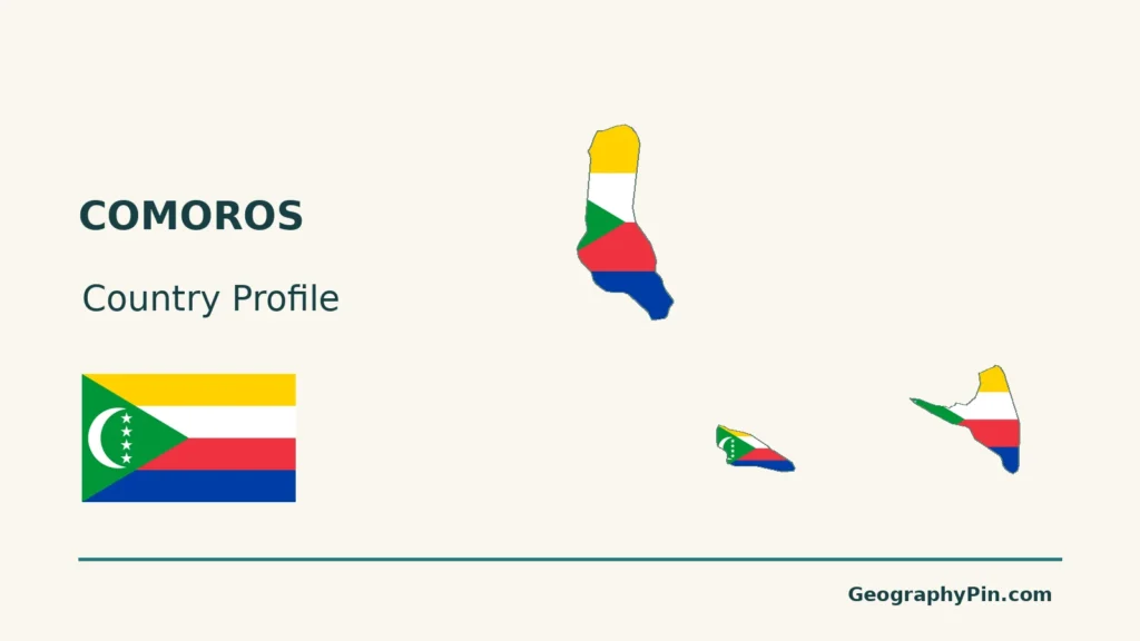
A map of Comoros needs two distinctions: volcanic islands are not interchangeable, and the geographic archipelago is not the same as the territory administered by the Union of the Comoros. Moroni, on Grande Comore, is the starting point for understanding both the state and its island connections.
Comoros is a volcanic island state in the western Indian Ocean, between mainland Africa and Madagascar. Its capital is Moroni on Grande Comore. The Union administers Grande Comore, Mohéli and Anjouan; it also claims Mayotte, which France administers. Mountainous terrain, permeable volcanic rock and ocean crossings shape water supplies, farming and connections between the islands.
How to use this article: Locate the country on the map, read the physical map, explore regional climates, or check the population reference.
1. Locate the State and Its Islands
Three administered islands in a wider archipelago
The Union of the Comoros is an island country off East Africa, at the northern entrance to the Mozambique Channel between mainland Africa and Madagascar. It administers Ngazidja (Grande Comore), Ndzuwani (Anjouan) and Mwali (Mohéli).
Mayotte, also called Maoré, belongs geographically to the same archipelago. France administers it, while Comoros claims it: Article 6 of the Comorian Constitution includes Mayotte in the national territory. The distinction between the four-island archipelago and the three administered islands is essential when reading maps and population totals.
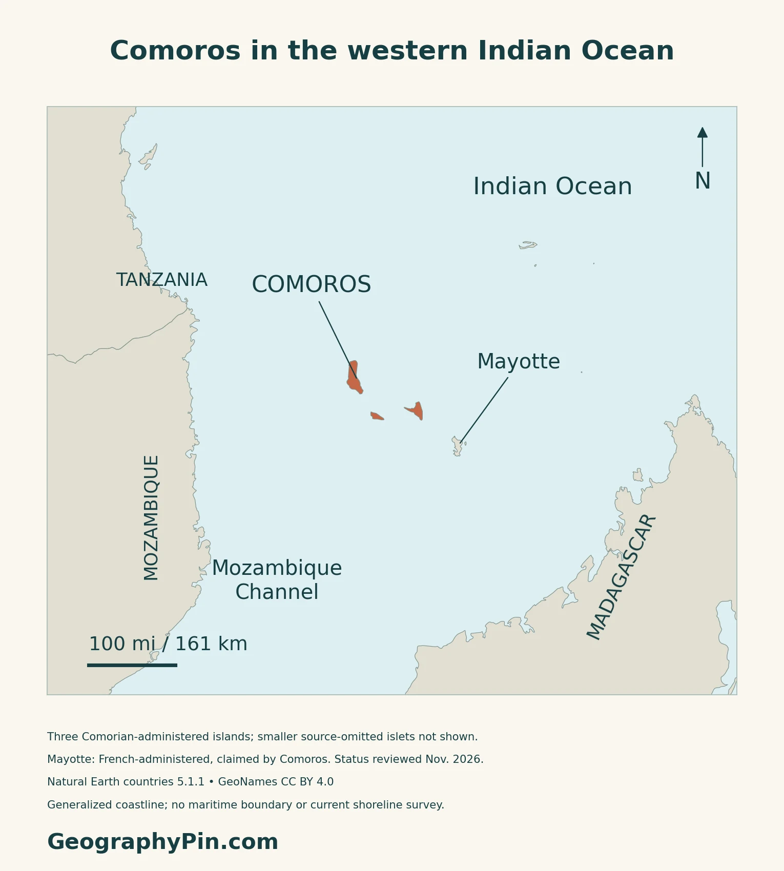
Moroni is on Grande Comore
Moroni, on Grande Comore, is the national capital. Mutsamudu is the principal city on Anjouan, and Fomboni on Mohéli.
2. Read the Volcanic Landscape
Three administered islands, different physical settings
| Island | Landscape reference | Useful distinction |
|---|---|---|
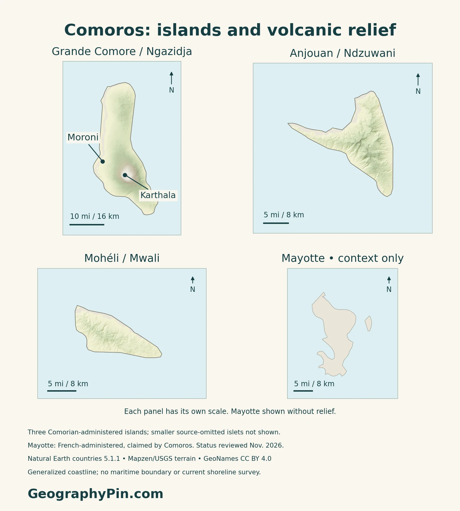
| Grande Comore / Ngazidja | Karthala’s broad volcanic slopes | Moroni lies on the western coastal margin |
| Mohéli / Mwali | Forested uplands, streams and coastal habitats | The island and surrounding waters form the Mwali Biosphere Reserve |
| Anjouan / Ndzuwani | Steep volcanic terrain cut by valleys | Its drainage differs from Grande Comore’s highly permeable lava landscape |
Karthala is a shield volcano with summit calderas
Karthala occupies southern Grande Comore. The Smithsonian’s Global Volcanism Program describes a basaltic shield volcano with overlapping summit calderas: collapse depressions at the top of a broad volcanic edifice. Eruptions have occurred both near the summit and on its flanks, and lava has reached the sea.
Mohéli connects upland forest with coastal ecosystems
UNESCO designated Mwali as a biosphere reserve in 2020. It includes the island’s land and a defined surrounding marine area, bringing forest, permanent rivers, mangroves, seagrass, lagoons and coral reefs into one conservation landscape. These habitats occupy different elevations and coastal settings rather than forming a single continuous forest.
A biosphere reserve includes places where people live and work as well as protected core areas. This designation is distinct from inscription on UNESCO’s World Heritage List.
3. Understand Rainfall and Water Supplies
Permeable lava changes where rainfall goes
Rainfall does not necessarily produce a dense network of surface rivers. The British Geological Survey describes highly permeable volcanic rocks in Comoros, allowing water to infiltrate and move below ground. Lava flows of different ages and older buried valleys can affect those underground pathways.
Grande Comore has few perennial rivers and depends heavily on groundwater and captured rainwater. On the other islands, streams are more important, but their flows can vary seasonally.
A wetter season, a drier season and local variation
The World Bank’s 2025 climate profile describes a hotter, rainier period from December through April and a cooler, drier period from May through November. Its monthly climatology uses 1991–2020 observations. Elevation and exposure to moist winds produce local differences within this island-wide seasonal pattern.
Heavy rainfall, coastal flooding and storm surge are different hazards. Steep ground can shed water quickly, while coastal settlements face processes arriving from both land and sea. The climate profile also identifies uncertainty in future annual rainfall: warming does not justify assuming that every island and every season will simply become drier.
4. Connect Farms, Water Systems and Ports
Food crops and export crops share limited land
The World Bank’s 2019 agricultural review describes farming systems shaped by altitude, soils and access to markets. Mixed cropping and agroforestry can place food plants alongside trees and export crops. Cloves, vanilla and ylang-ylang connect agricultural production with overseas demand, but they do not describe everything grown for local meals.
Steep cultivated land also creates a soil-management problem. Vegetation cover, cropping practices and the condition of slopes influence how much soil stays in place during intense rain.
Water supply also depends on infrastructure
UNDP’s account of its climate adaptation work describes boreholes, treatment plants, reservoirs and distribution networks. These are different parts of a supply system: finding water below ground does not by itself deliver safe water to a household. Storage and distribution help connect variable natural supplies with demand.
Ocean crossings connect local markets
Inter-island connections move essential goods as well as passengers. In an October 2024 report on its port-security work, the International Maritime Organization identifies Mutsamudu on Anjouan as a transshipment hub for rice, fuel and other supplies moving to the country’s other islands.
This gives a port a wider geographic role than the town beside it. Goods unloaded on one island may need another sea crossing before reaching their final market.
5. Dated Country Facts and Institutions
| Item | Reference | Date or scope |
|---|---|---|
| Capital | Moroni | On Grande Comore |
| Population | 921,626 projected residents | INSEED medium scenario, 2025; three administered islands |
| Area | About 719 sq mi (1,862 km²) | Three-island area; excludes Mayotte |
| Official languages | Shikomor, French and Arabic | Shikomor is also the national language; Constitution, Article 9 |
| Currency | Comorian franc (KMF) | National currency |
| Government | Unitary republic | 2018 constitutional structure |
| Island administration | Grande Comore, Anjouan and Mohéli | Island governors within the Union; excludes French-administered Mayotte |
A projection, not a new census count
INSEED’s revised medium projection uses the 2017 census and demographic assumptions updated with the 2022 MICS survey. Its 2025 total covers Grande Comore, Anjouan and Mohéli, not Mayotte. INSEED identifies the next population census as planned for 2027; its launch preparations are not completed census results.
The three-island area used here follows UNDP’s explicit geographic scope and France Diplomatie’s country reference. UNData separately lists 863 sq mi (2,235 km²) for 2023 without explaining that difference on its country page; the two figures should not be treated as a land-versus-water pair.
Three official languages
Article 9 of the 2018 Constitution makes Shikomor, French and Arabic official languages and also identifies Shikomor as the national language.
What Did We Learn Today?
Comoros combines volcanic uplands with coastal settlements and sea routes between islands. Its three administered islands need to be distinguished from the wider archipelago and the claim to French-administered Mayotte. Permeable rock, seasonal rainfall and water infrastructure help explain supplies, while farms and ports connect island landscapes with local and overseas markets.
Sources & Data Notes
Statistical references retain their stated dates and territorial coverage. The island maps distinguish administration from sovereignty claims. Climate seasons use the World Bank’s 2025 profile and its 1991–2020 monthly normal; this is not a weather forecast. The agricultural review dates to 2019, and the port assessment to October 2024. Mwali’s UNESCO designation is a biosphere reserve, not World Heritage inscription. Volcano history does not establish a current alert level.
- INSEED: revised 2017–2042 medium population projections; 2025 three-island resident total
- INSEED: RGPH5 planned for 2027
- 2018 Constitution, English translation hosted by WHO: Articles 1, 6, 9, 10 and 99
- WIPO Lex: 2018 constitutional version and commencement metadata
- France: Decree 2025-1427, Département-Région de Mayotte provisions effective in 2026
- UNDP country profile: three-island geographic scope and 1,862 km² area
- France Diplomatie: Comoros reference, updated October 22, 2026
- UNData: 2023 surface-area series and currency; population projection not used
- Smithsonian Global Volcanism Program: Karthala
- British Geological Survey: Hydrogeology of Comoros
- World Bank: Climate Risk Country Profile, Comoros (2025)
- UNESCO: Mwali Biosphere Reserve (designated 2020)
- World Bank: Jumpstarting Agricultural Transformation (2019)
- UNDP: Comoros climate adaptation and water infrastructure
- International Maritime Organization: Mutsamudu port assessment (October 2024)
Map method: Original GeographyPin maps use public-domain Natural Earth countries 5.1.1. All three Comoros source components are retained; smaller omitted islets are not invented. Mayotte’s two source components appear neutrally as French-administered territory claimed by Comoros, not as a sovereignty ruling. Status was reviewed in November 2026, not the coastline surveyed then. No maritime boundaries are drawn. GeoNames coordinates are credited under CC BY 4.0. Real Mapzen Terrain Tiles supply relief, with Mapzen/USGS and upstream credits; negative coastal artifacts are transparent, not assigned invented heights. Mayotte has no terrain shading. Each inset has its own WGS84 scale. The cover shows only the three administered main islands and uses the public-domain Commons flag rendition; its separate complete four-star flag does not imply Comorian administration of Mayotte.
