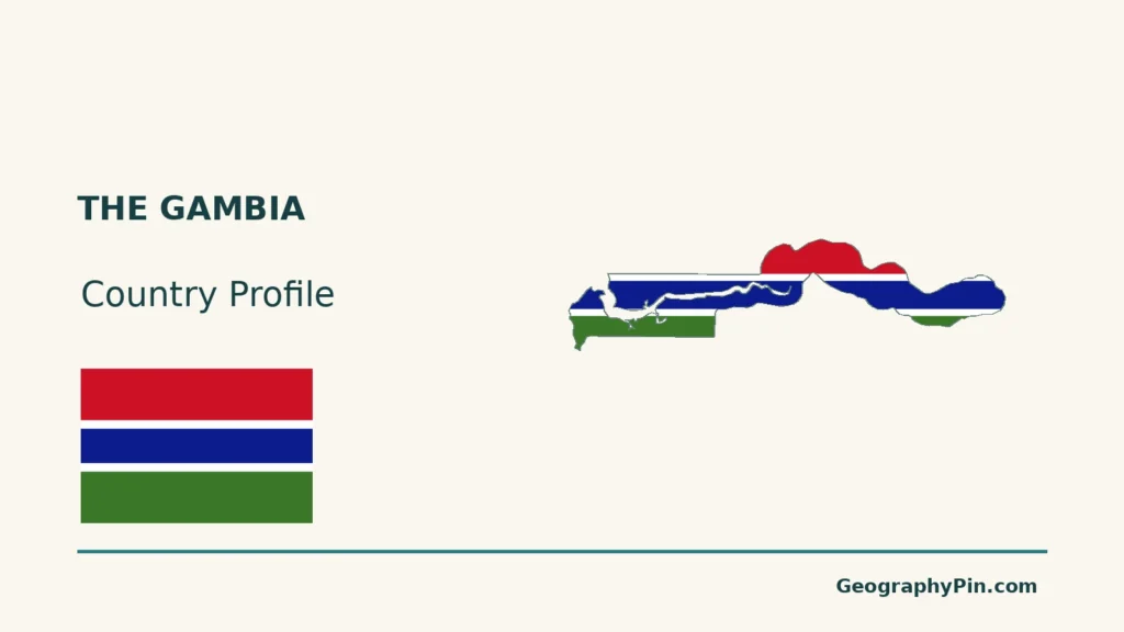
The Gambia is a West African country with an Atlantic coast and a narrow territory extending inland beside the Gambia River. The river, the sovereign country and the wider river basin are closely connected, but they cover different areas. That distinction is essential to understanding the country’s unusual outline.
The Gambia follows a narrow corridor along the lower Gambia River, with an outlet to the Atlantic. Its borders reflect colonial boundary agreements, including the Anglo-French Convention of 1889, rather than the limits of the whole river basin. Senegal surrounds its land boundaries, but the western coastline keeps the country open to the ocean.
How to use this article: Locate the river country, compare the landscape settings, or follow seasonal saltwater.
1. Locate a River Corridor With an Atlantic Outlet
Surrounded by Senegal on land, open to the ocean
The Gambia lies in West Africa, with Senegal along its northern, eastern and southern land boundaries. Its western coast opens onto the Atlantic. It is therefore not landlocked or wholly enclosed within Senegal.
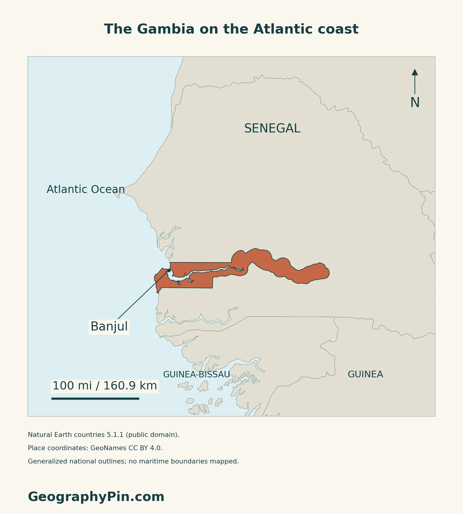
Banjul is the capital near the river mouth. Its harbour occupies the southeastern side of the city on the estuary, according to the Gambia Ports Authority. The capital’s coastal position contrasts with the long inland part of the country.
The outline combines river access and political history
The National Land Policy traces the borders to the Anglo-French Convention of 1889 and subsequent demarcation between 1891 and 1905.
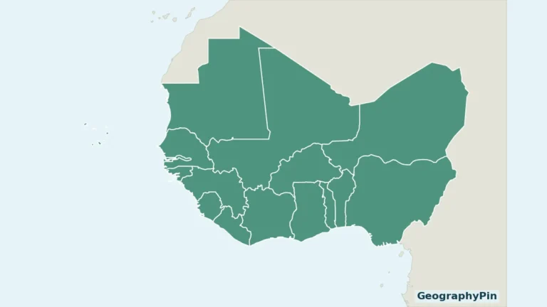
Use the West Africa map to compare this narrow territory with Senegal and the wider region.
2. Compare the Estuary, River Margins and Low Uplands
Small differences in height can separate distinct settings
The government’s 2007 adaptation programme describes generally low relief, with extensive land close to sea level.
| Setting | What distinguishes it |
|---|---|
| Atlantic coast | Low sandy coastal terrain. |
| Estuarine margins | Mangrove swamps and saline alluvial soils. |
| River-adjacent lowlands | Grassy alluvial areas, locally called banta faros. |
| Low hills and plateaus | Shallow valleys and sandy upland soils. |
3. Follow Water Beyond the National Border
The river begins outside The Gambia
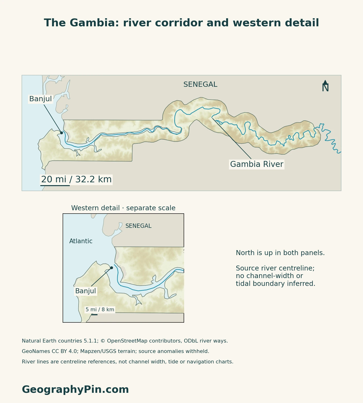
The Gambia River rises in Guinea’s Fouta Djallon highlands, crosses Senegal and then flows through The Gambia to the Atlantic. The national territory is only part of that river system; upstream water does not originate solely within Gambian borders.
Freshwater flow and Atlantic tides meet
The Global Center on Adaptation’s March 2026 assessment explains that lower dry-season river discharge allows saltwater to penetrate farther inland. Wet-season freshwater flow changes that balance. The salty-to-fresh transition is consequently seasonal, not a permanent line that can be drawn across this country map.
This matters for irrigation and water use beside the river.
4. Connect the Rainy Season With Wetland Landscapes
A short wetter part of the year and a longer dry period
The older national adaptation programme describes a broadly June-to-October rainy season. The 2026 water assessment identifies July, August and September as its main rainfall months. These are climatological patterns, not guaranteed dates for the start or end of rain.
The national programme also notes the dry-season Harmattan, which can carry Saharan dust, and warmer conditions inland than along the Atlantic coast. Coastal and inland places therefore need not experience identical conditions even across this narrow country.
Mangroves connect ecology and livelihoods
Tanbi’s mangroves near Banjul illustrate the estuarine environment. A 2012 field study documented how nearby communities used mangrove resources and how fishing and oyster collection contributed to livelihoods. This is a dated research example, not a current census of resource users.
5. Check Dated Country Facts
| Item | Reference |
|---|---|
| Capital | Banjul |
| Population reference | 2,422,712 people; preliminary 2024 census, de facto population |
| Surface area | About 4,361 sq mi (11,295 km²); UNData’s 2023 reference |
| Currency | Dalasi (GMD) |
| Official language | English, as identified by GIEPA |
| Government | Republic |
| Census geography | Eight local government areas in the 2024 report |
A preliminary count, not a current projection
GBoS conducted the census in May and June 2024. Its August preliminary report labels the national figure a de facto population and includes household, institutional and floating populations. It is not a count of Gambian citizens alone. The official census download page still identified this report as preliminary when checked on November 17, 2026; a final replacement was not verified.
Banjul and Kanifing are separate statistical units
The census reports Banjul and Kanifing separately. Serekunda belongs to the wider Kanifing municipal setting, rather than being another name for the national capital. IOM’s municipal profile distinguishes Kanifing’s local government from its constituent settlements.
UNData’s capital-population entry combines the local government areas of Banjul and Kanifing. That combined geography should not be mistaken for the population within Banjul alone.
For a broader comparison, see the African countries and capitals reference.
What Did We Learn Today?
Its Atlantic outlet, low uplands and tidal wetlands make more sense when national boundaries, landforms and seasonal water conditions are read separately.
Sources & Data Notes
Sources, dates and map conventions
Population is the August 2024 preliminary GBoS census total, not a verified final result or current projection. The census report’s de facto scope is retained; its eight local government areas are statistical units, not a claim of eight administrative regions. Surface area follows UNData’s 2023 reference, not land area alone. English is corroborated by the government investment agency; no draft constitutional provision is treated as enacted law. The 2022 IOM municipal profile is used only for the Kanifing–Serekunda distinction, not current population or constituency counts. The 2007 programme is used for stable physical and seasonal context, not present population or implementation claims. The 2026 water report supports seasonal salinity, not a fixed intrusion limit or an assertion that salinity is steadily increasing. No current dam-completion status, exact national highpoint or channel-navigation advice is inferred. Tanbi livelihood evidence is explicitly from a 2012 study.
- GBoS: original August 2024 preliminary population and housing census report
- GBoS: official census download listing, checked November 17, 2026
- UNData: 2023 surface reference, currency and capital-population geographic scope
- Gambia Investment and Export Promotion Agency: English official-language description
- IOM: 2022 Kanifing municipal profile, hosted by the municipal council
- Gambian Embassy: Banjul, republic and language context
- Ministry of Lands: National Land Policy 2026–2035, physical settings and boundary history
- Government: November 2007 National Adaptation Programme of Action, stable physical and seasonal context
- Global Center on Adaptation: March 2026 water resources climate assessment
- Gambia Ports Authority: Banjul harbour’s estuarine location
- Satyanarayana and colleagues: 2012 Tanbi mangrove field study, author-hosted original
Original maps use Natural Earth countries 5.1.1 (public domain), © OpenStreetMap contributors river ways (ODbL; database November 17, 2026), and GeoNames coordinates (CC BY 4.0). The supplied river segments are plotted without invented connections; the western inset has its own scale. Generalized national geometry is not a surveyed shoreline or channel-width mask.
Qualitative relief uses Mapzen/USGS terrain tiles. Negative samples along the coast and inland river corridor, plus 12 isolated positive spikes identified by a local-median test, are withheld rather than displayed as elevations. Colors are not measured land-cover, salinity or flood zones. The cover combines the generalized outline with the reusable Flagpedia rendition; its 3:2 proportions are rendition specifications, not independently verified statutory dimensions.