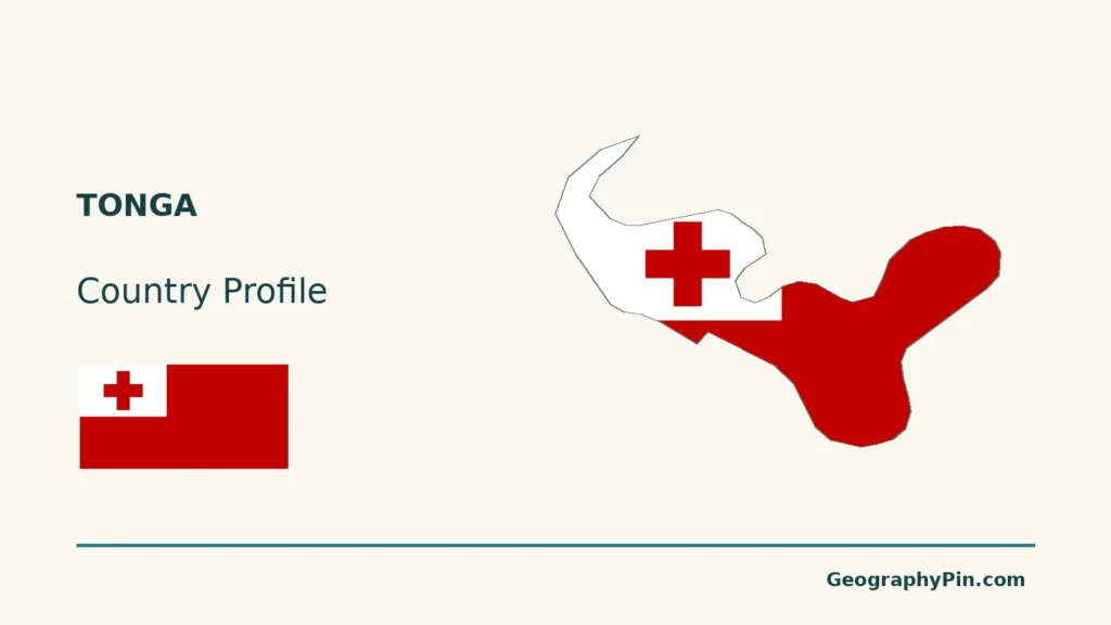
Tonga is not one low coral island repeated across the Pacific. Raised limestone landscapes, sandy cays and volcanic islands sit within the same kingdom.
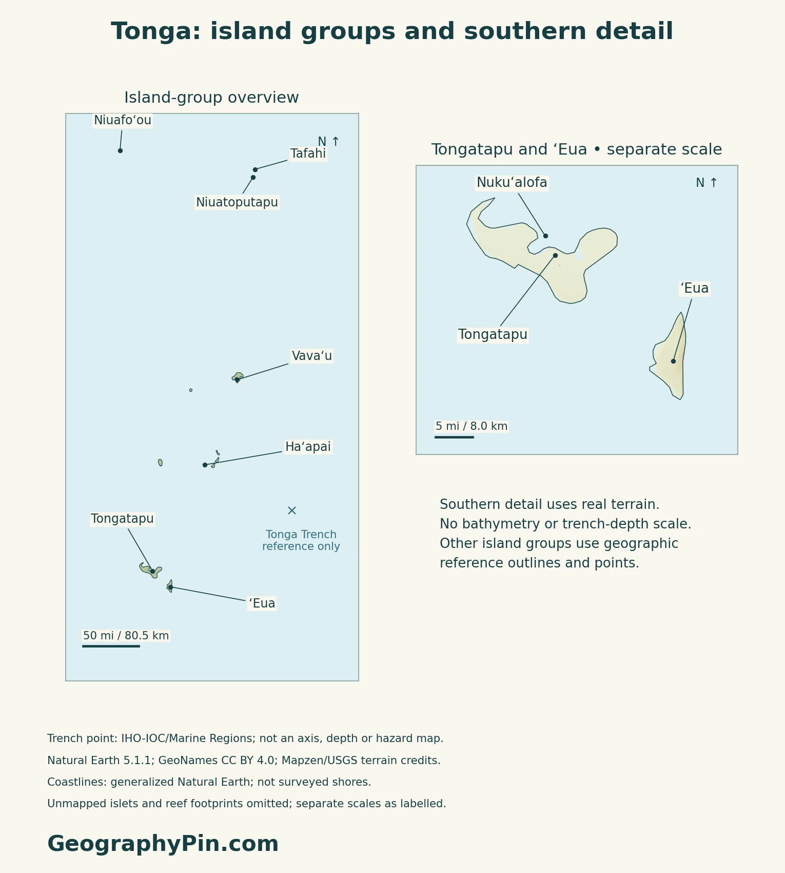
Tonga is a Polynesian island country in the South Pacific, with Nukuʻalofa as its capital on Tongatapu. Its islands include raised coral limestone landscapes and volcanic islands associated with an active plate boundary. Tongatapu, Vavaʻu, Haʻapai, ʻEua and the northern Niuas should be located separately rather than treated as one continuous landmass.
How to use this article: Locate the island groups, compare their physical settings, or examine freshwater sources.
1. Locate the Islands, Not Just the Capital
Read the island groups at different scales
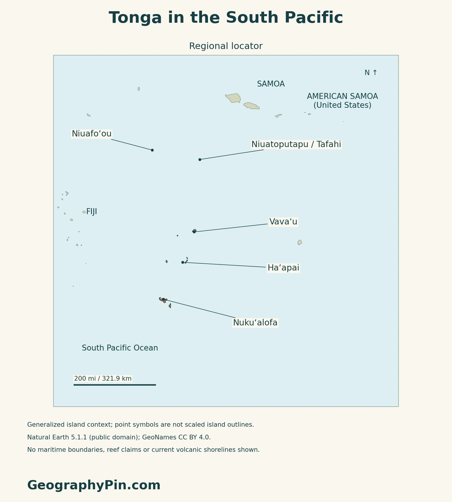
Tonga is a Polynesian country in the South Pacific. Tongatapu, Vavaʻu and Haʻapai are names to keep separate from the country as a whole. ʻEua lies near Tongatapu, while the northern Niuas extend the geographic picture beyond the main southern groups.
Nukuʻalofa is the capital, on Tongatapu. The final 2021 census counted 74,320 people in the Tongatapu division, about 74% of the national total. This is not Nukuʻalofa’s city population. A capital marker identifies one settlement, not the extent of the kingdom. The Oceania capitals reference supplies the wider regional comparison.
Use each inset’s own scale bar rather than comparing apparent island sizes between panels.
2. Compare Coral Platforms and Volcanic Islands
The landscape is more varied than a two-part label
| Place | Physical character |
|---|---|
| Tongatapu and Vavaʻu | Raised coral limestone islands, with tilted surfaces and contrasting coastlines. |
| ʻEua | Predominantly raised coral terrain, with older volcanic rocks exposed. |
| Parts of Haʻapai | Low coral platforms and sandy cays, alongside volcanic islands. |
| Tofua and Kao | High volcanic islands, unlike the low coral settings. |
The Pacific Soils Portal also distinguishes raised volcanic islands from high volcanic islands. Volcanic ash contributes to soils on many islands, including those with coral limestone beneath. Bedrock, soil and present-day relief thus describe different aspects of the same landscape.
Why a trench and an island arc occur together
The Tonga Trench lies in a subduction zone where the Pacific Plate descends westward. Research on the trench and forearc distinguishes the Tofua volcanic arc from the Tonga Ridge farther east. This arrangement helps explain why nearby islands can have different geological histories.
3. Follow Rainfall and Freshwater Differences
A wetter north does not mean identical island climates
Tonga Meteorological Service describes a wetter season from November through April and a drier season from May through October. Northern islands generally receive more rain, but Haʻapai occupies a relatively dry zone, so the pattern is not a simple smooth increase from south to north.
The South Pacific Convergence Zone influences rainfall, while El Niño can bring prolonged drought, particularly to central and southern Tonga. These are broad climatic patterns from an undated climate summary, not a forecast for the coming season.
Rain storage and groundwater serve different roles
UNDP’s adaptation profile identifies stored rainwater and freshwater lenses within porous limestone as important water sources. A freshwater lens is groundwater held above denser saline water, not an underground river running between the islands.
Drought can reduce collected rainwater, while saltwater intrusion threatens groundwater quality.
4. Separate a Historic Eruption From Current Conditions
The January 2022 event changed more than one island
On January 15, 2022, Hunga Tonga–Hunga Haʻapai erupted explosively and generated destructive tsunami waves. NOAA’s account places the volcano about 40 miles (65 km) northwest of Tongatapu and documents damage on several islands, including Tongatapu, Mango and Nomuka Iki.
This is a dated event, not a description of present tsunami conditions. Older island descriptions and pre-eruption shorelines should not be assumed to represent the post-eruption landscape. Nor does the position of a volcanic center alone describe the reach of a tsunami.
Connections beyond the islands shape everyday costs
The National Reserve Bank’s August 2026 economic update highlights Tonga’s dependence on imports and exposure to international fuel prices and supply-chain disruption. Its discussion also records tourism receipts, agricultural exports and remittance flows. These connections link a small island economy to markets and households far beyond its shores.
5. Read Country Facts With Their Dates and Scope
| Item | Reference |
|---|---|
| Government form | Constitutional monarchy |
| Capital | Nuku’alofa |
| Population | 100,179 people; final census, November 30, 2021 |
| Surface area | About 288 sq mi (747 km²); UNData’s 2023 reference, not maritime extent |
| Languages | Tongan and English, listed as official by Tonga Tourism |
| Currency | Paʻanga (TOP) |
| Census divisions | Tongatapu, Vava’u, Ha’apai, ‘Eua and Ongo Niua |
A census count with a specific reference night
The census covered all divisions and counted people present in Tonga on census night. Its final results were first released in October 2022. These are not a count of Tongans worldwide or a new 2026 population total.
The Statistics Department’s October 6, 2026 notice described training and preparations for the next census, not completed results. The five divisions above are the units used in the 2021 census, not a count of islands.
What Did We Learn Today?
Keep the country, island-group and individual-island scales separate when reading the maps or using a dated population count.
For the broader classification, see the island-country guide.
Sources & Data Notes
Sources, dates and map conventions
The population and division figures are final 2021 census results, not the earlier preliminary release or a 2026 count. The original final factsheet and Statistics Department coverage/release pages were read; the full Volume 1 web download exceeded the reader size limit. Surface area follows UNData’s 2023 reference. Language wording is attributed to official tourism guidance, not an independently verified general constitutional provision. Sources checked in November 2026. Undated soil and climate references support broad patterns, not current shorelines or seasonal forecasts. The geological paper supports tectonic context, not current hazard assessment. NOAA’s event account describes January 2022; the economic update retains its August 2026 title although much of its activity data concerns June.
- Tonga Statistics Department: final 2021 census factsheet
- Tonga Statistics Department: 2021 census coverage
- Tonga Statistics Department: final results release, October 2022
- Tonga Statistics Department: census preparations, October 6, 2026
- UNData: Tonga, including 2023 surface-area reference
- Tonga Tourism: language and currency guidance
- Tonga Tourism: Tongatapu and Nuku’alofa
- Australian DFAT: Tonga country brief
- Pacific Soils Portal: Tonga parent material
- Wright and colleagues: Tonga Trench and Forearc, 2000
- Tonga Meteorological Service: climate summary
- UNDP: Tonga adaptation profile
- NOAA: January 15, 2022 eruption and tsunami
- National Reserve Bank: August 2026 economic update
Map method: Original maps use public-domain Natural Earth 5.1.1 generalized islands and GeoNames coordinates (CC BY 4.0). Niuafo‘ou, Niuatoputapu and Tafahi are reference points, not scaled outlines; small islets and uncertain reef footprints are omitted. The cover depicts Tongatapu only. Mapzen terrain supplies the southern detail, with Mapzen/USGS upstream credits; 905 negative land-mask samples are withheld, not replaced with invented heights. Coastlines are generalized, not a current survey; this places the unchanged sourced Nuku‘alofa marker just offshore of the rendered land. Insets have independent WGS84 distance scales. The IHO-IOC/Marine Regions trench reference is not a surveyed axis, depth or island-height measurement. These maps are not for navigation or current hazards. The Commons flag rendition is CC0/public domain; its 1:2 ratio comes from that rendition, not a dimensional specification in Constitution clause 47.