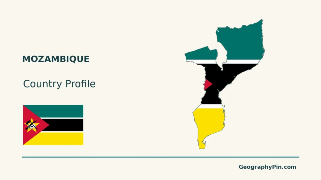
Mozambique’s long Indian Ocean frontage connects several different landscapes: southern coastal plains, central river valleys and deltas, and higher terrain farther inland and north.
Mozambique is a southeastern African country on the Indian Ocean, with Maputo as its capital. Coastal lowlands give way to inland plateaus and mountains, while the Zambezi crosses the country toward a broad delta. Lake Niassa, also called Lake Malawi or Lake Nyasa elsewhere, borders its northwest. Rivers, seasonal rain and ports connect the interior with the coast.
How to use this article: Locate the country on the map, read the physical map, explore rainfall seasons, or check the population reference.
1. Locate Mozambique and Its Neighbors
An Indian Ocean country with six land neighbors
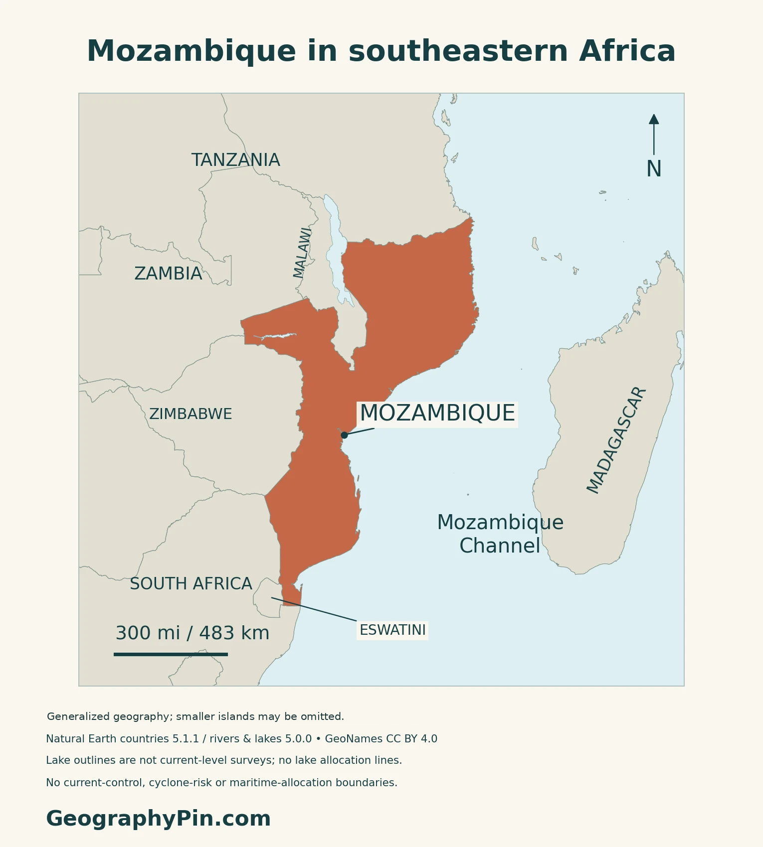
Mozambique lies on Africa’s southeastern coast, within the UN’s Eastern Africa statistical region. Tanzania borders it to the north; Malawi, Zambia and Zimbabwe lie along its inland side; South Africa and Eswatini meet its southern end. The Mozambique Channel separates its coast from Madagascar.
Lake Malawi, also called Lake Nyasa and known in Mozambique as Lago Niassa, lies along the country’s northwestern side. These regional names refer to the same lake.
Maputo is the capital, not the whole southern province
Maputo is the national capital near the southern end of the coast. Maputo City is administered separately from Maputo Province, whose administrative center is Matola. A figure for the city therefore does not describe the entire surrounding province.
2. Compare the Coast, Delta and Uplands
Low coastal ground contrasts with higher inland terrain
| Setting | Physical character | Map reference |
|---|---|---|
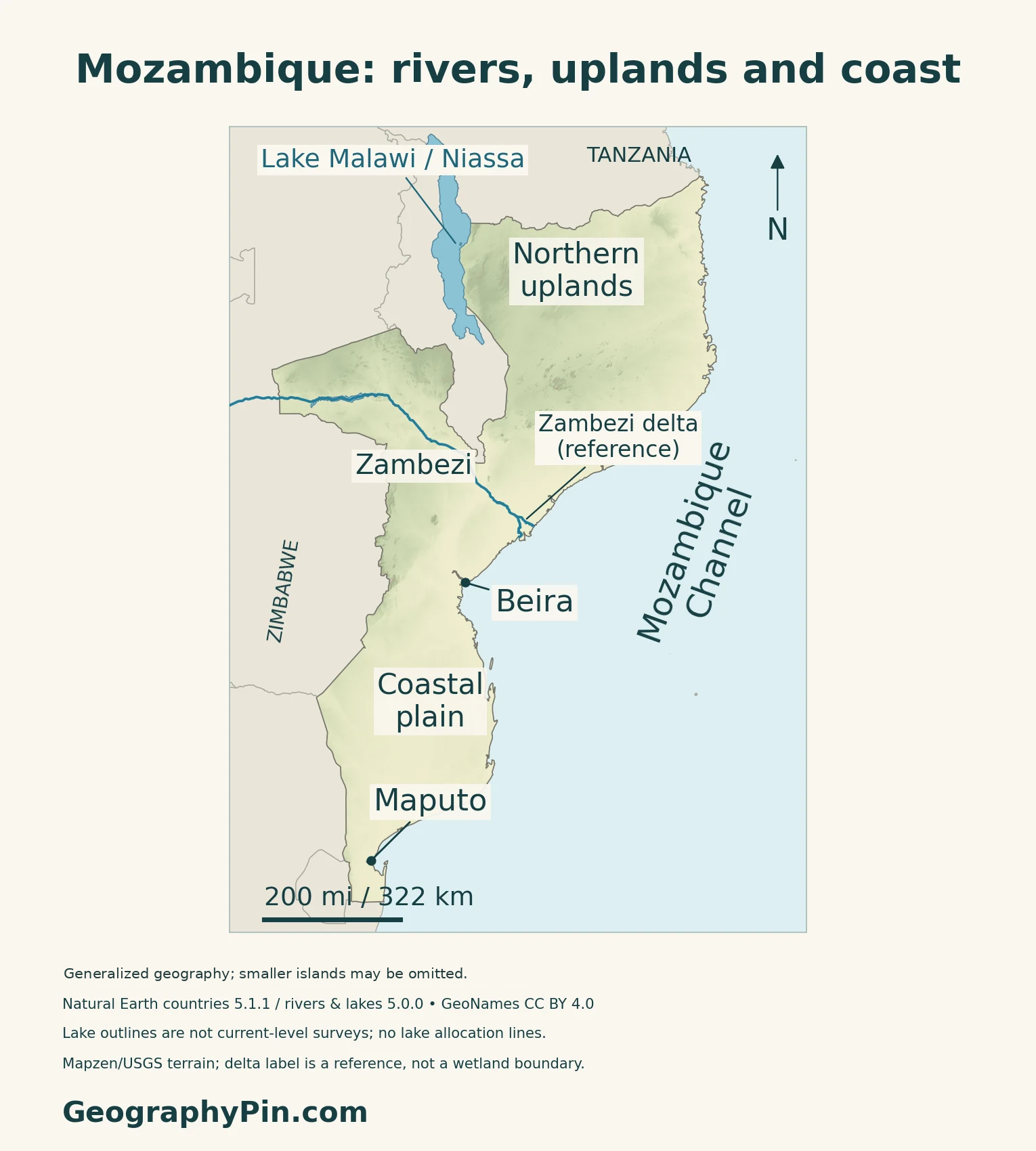
| Coastal plain | Low terrain along the Indian Ocean margin | Maputo in the south; Beira farther north |
| Zambezi valley and delta | River corridor ending in an alluvial plain | Central Mozambique |
| Northern and interior uplands | Plateaus and mountain country | Higher terrain away from much of the coast |
| Lake Niassa margin | A large Rift Valley lake and adjoining slopes | Northwestern border region |
The delta is a mosaic of wetlands
The Zambezi Delta Ramsar site includes a broad alluvial plain with grasslands, woodland, swamps and mangroves. Freshwater from upstream meets coastal and tidal processes here, creating different habitats rather than a uniform marsh.
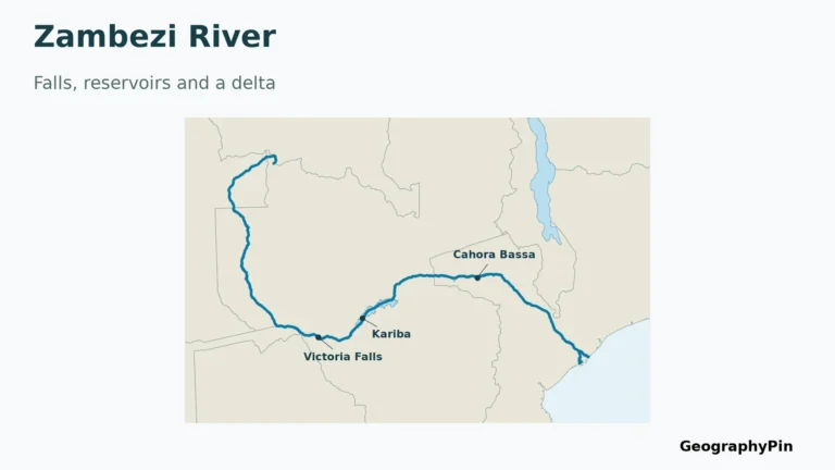
The Ramsar record identifies flood regulation, coastal protection and fisheries among the delta’s benefits. It also identifies upstream hydroelectric dams as a pressure on this system. The river’s condition at the coast is therefore connected to water management far inland. For the full course and reservoirs, use the Zambezi River map.
One lake has several regional names
Mozambique’s Lake Niassa and Coastal Zone Ramsar site was designated in 2011; the site is not the whole international lake.
The designation describes both low plains and steep mountain margins, along with fisheries and bird habitats. The northwestern lakeshore is a different environment from the Indian Ocean coast: it belongs to an inland freshwater system.
3. Read Rainfall and Flood Exposure
The wetter season falls in the hotter months
Mozambique’s updated climate contribution, submitted in November 2021, describes a broad hot, rainy season from October to April and a cooler, drier season from May to September. Northern areas generally receive more rain, while central and southern conditions vary between the coast and interior.
Elevation and local exposure also affect planting and water supplies.
Beira shows how rivers, tides and urban drainage interact
Beira’s flood exposure cannot be understood from rainfall alone. The World Bank’s 2022 account of work on the Chiveve describes a tidal river passing through the city, with mangroves and drainage routes affected by waste, vegetation loss and restricted tidal exchange.
The project combined drainage improvements with mangrove restoration, a widened tidal basin and a controllable outlet. It illustrates how coastal flood management can join engineered structures with space for water and vegetation.
4. Connect Farming and Ports with the Interior
Floods and dry spells affect different stages of farming
In its March 2026 account of southern flooding, FAO described rice transplanting interrupted around Chókwè and maize lost near harvest. The timing mattered: water arriving at a vulnerable growth stage can erase work already invested in a crop. Damaged roads also restricted access to markets and services.
Drought poses a different problem. FAO’s August 2025 field account from Manica and Sofala described farmers diversifying maize, millet and beans with vegetables, using seed support and farmer field schools. These are local examples of adaptation, not evidence that every farm follows the same crop mix.
Ports serve inland routes as well as coastal cities
Mozambique’s ports are linked with regional transport corridors. The national ports and railways company, CFM, describes Maputo’s connections toward southern African neighbors, Beira’s inland regional corridor and a Moatize–Nacala route through Malawi.
This helps explain why a country with a long coastline is also important to inland trade. Maputo’s capital role, Beira’s central coastal setting and Nacala’s northern corridor are different geographic functions.
5. Dated Country Facts and Institutions
| Item | Reference | Date or scope |
|---|---|---|
| Capital | Maputo | National capital; separate from Maputo Province |
| Population | About 34.959 million | INE national projection for 2026, published March 2026 |
| Surface area | About 308,642 sq mi (799,380 km²) | UN reference, 2023; total surface, not land-only |
| Official language | Portuguese | Constitution, Article 10 |
| Currency | Metical (MZN) | National currency |
| Government | Unitary republic | Constitutional structure |
| Administration | 10 provinces plus Maputo City | City has province-level status |
A projection is different from a census count
INE’s March 2026 statistical bulletin reports 34.959 million people for 2026 from its 2017–2050 projection series. It is a national population projection, not a count conducted in 2026.
The 2017 census had an August 1 reference date. INE adjusted the national count after a coverage survey identified omissions, so its adjusted total differs from the number directly enumerated.
Official Portuguese and national languages
Article 10 designates Portuguese as the official language. Article 9 separately recognizes national languages as cultural and educational heritage and calls for their development. These provisions do not mean that everyone uses Portuguese as a first language. The government lists languages including Emakhuwa, Xironga, Cinyanja and Shimakonde.
The Constitution establishes a unitary state. Provinces and the separately administered capital organize national territory. The 2026 INE table lists Maputo Province and Maputo City as distinct units alongside the other nine provinces.
What Did We Learn Today?
Mozambique combines coastal lowlands, a major river delta, inland uplands and a northwestern lakeshore. The Zambezi links upstream water management with coastal wetlands, while ports connect the country with inland markets. Seasonal rainfall and the timing of floods or dry spells help explain why farming and settlement conditions differ across this long country.
Sources & Data Notes
Population retains its national projection year and series rather than being presented as a new census. Physical descriptions from historical FAO research are used for stable terrain only. Ramsar records describe their designated sites, not complete international basins or current biodiversity censuses. The climate contribution was submitted in November 2021. Beira’s project account dates to 2022; FAO flood and drought examples retain their 2026 and 2025 observation dates. Transport-corridor descriptions are not live service schedules.
- INE: Indicadores em Flash, March 2026; national 2026 population projection
- INE: 2017 census indicators; enumerated and coverage-adjusted totals
- INE census metadata: August 1, 2017 reference date and national coverage
- UNData: 2023 surface area, region, capital and currency
- Assembly of the Republic: consolidated Constitution; language provisions and Articles 309–310 on Maputo
- Government portal: capital, national languages and provincial list
- UK PCGN: Mozambique names and administrative structure, November 2024
- FAO: Mozambique natural resources and livelihoods study, historical physical description
- Ramsar: Zambezi Delta site record, last published October 2015
- Ramsar: Lake Niassa and its Coastal Zone, designated April 2011
- Mozambique: updated first climate contribution, submitted November 2021
- World Bank: Chiveve restoration and Beira drainage project (January 2022)
- FAO: southern Mozambique flood impacts (March 2026)
- FAO: drought recovery field account in Manica and Sofala (August 2025)
- CFM: regional rail and port corridors
Map method: Original GeographyPin maps use public-domain Natural Earth countries 5.1.1 and rivers/lakes 5.0.0. All source national components are retained; smaller omitted islands are not invented. The territorial outline includes lake territory. Body maps overlay Lake Malawi/Niassa and Cahora Bassa as water and exclude them from terrain shading, without drawing lake allocation boundaries. These generalized outlines are not current-level surveys. The mapped lower Zambezi uses supplied river and reservoir-centerline geometry, clipped to regional context; the delta label adds no invented distributaries or wetland boundary. GeoNames city coordinates are credited under CC BY 4.0. Landscape labels are broad references. Real Mapzen Terrain Tiles provide relief with Mapzen/USGS and upstream credits; isolated negative artifacts are transparent, not replaced with invented heights. WGS84 scales apply at their displayed latitude. The cover uses the same territorial outline and public-domain Commons flag rendition, with a complete separate flag.