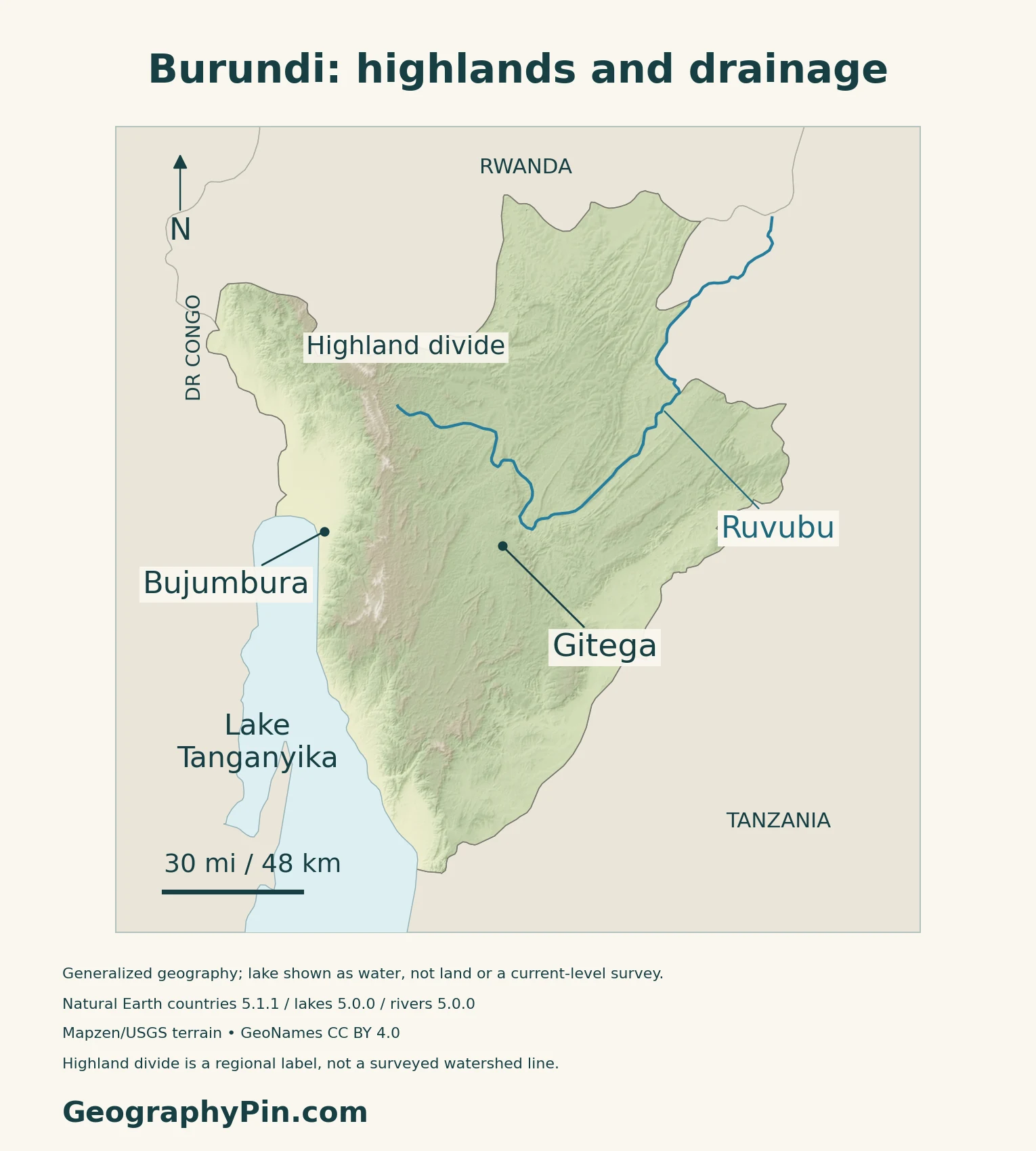
Burundi’s two best-known cities occupy contrasting settings: Gitega is inland among the hills, while Bujumbura faces Lake Tanganyika below the western escarpment. Between the lakeshore and the interior, changes in elevation help explain the country’s drainage, climate and land use.
Gitega is Burundi’s political capital; Bujumbura is its economic capital and a major lakeside city. This landlocked East African country borders Rwanda, Tanzania and the Democratic Republic of the Congo. Its landscape rises from Lake Tanganyika and the Imbo plain through steep western slopes to highlands and rolling plateaus, with rivers draining toward both the Congo and Nile systems.
How to use this article: Locate the country on the map, read the physical map, explore regional climates, or check the population reference.
1. Locate Burundi and Its Two City Roles
A landlocked country beside Lake Tanganyika
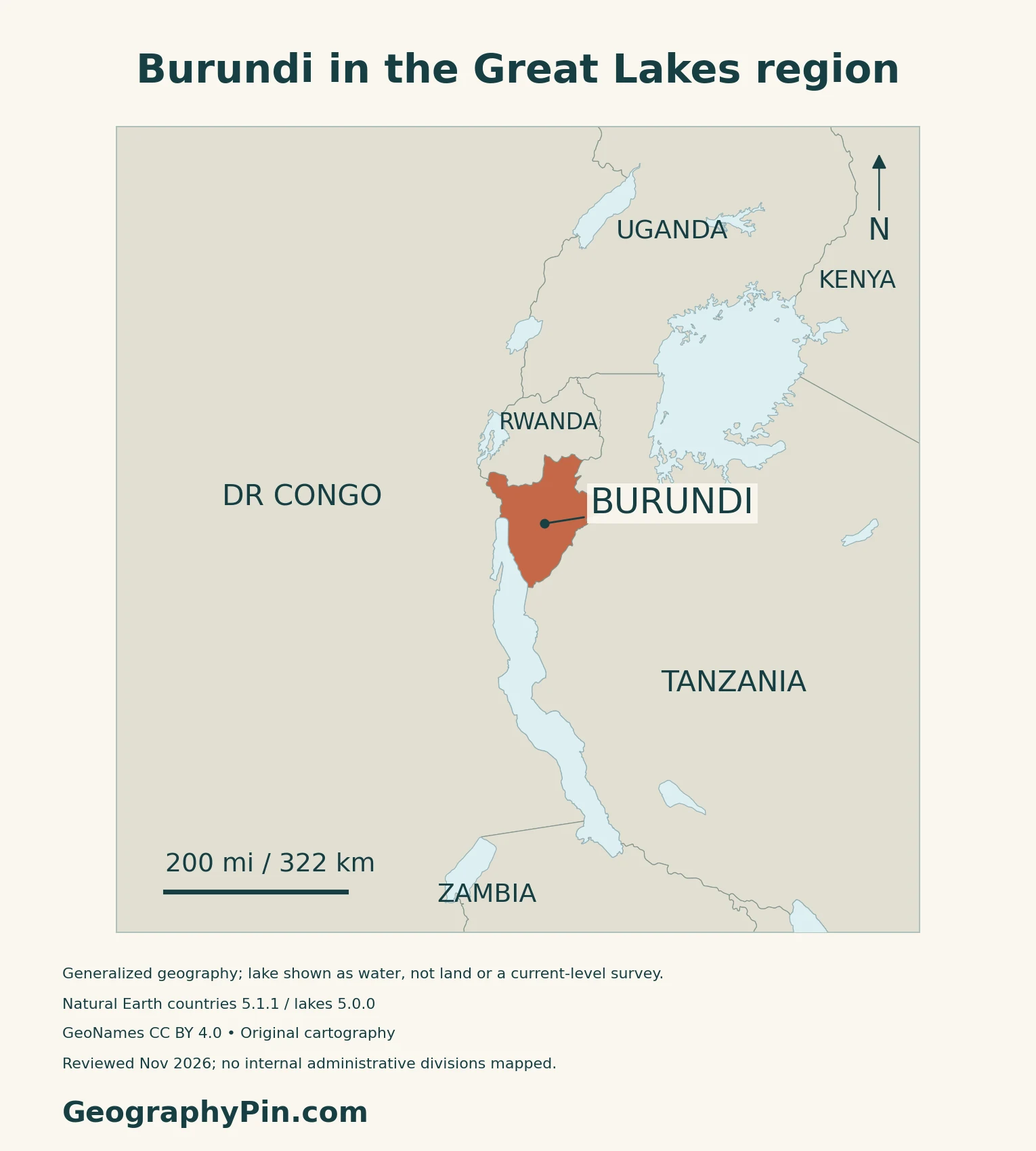
Burundi is a landlocked country in East Africa’s Great Lakes region. Rwanda borders it to the north, Tanzania to the east and south, and the Democratic Republic of the Congo to the west. Lake Tanganyika forms part of its southwestern edge.
Gitega and Bujumbura have different legal roles
Gitega is Burundi’s political capital, while Bujumbura is its economic capital. Law No. 1/04 of February 4, 2019 established that distinction and took effect on promulgation. Gitega occupies the interior highlands; Bujumbura lies beside Lake Tanganyika. The law assigns ministerial departments between the two capitals by decree, rather than declaring that every government office must occupy one city.
2. Read the Highlands and Lakeshore
A short west-to-east journey crosses contrasting landforms
| Setting | Physical character | How to read it |
|---|---|---|
| Imbo plain and lakeshore | Low western plain beside the Rusizi and Lake Tanganyika | Bujumbura occupies this lowland margin |
| Mumirwa and Congo–Nile highlands | Steep slopes rise toward a mountain ridge | The ridge separates major drainage directions |
| Central plateaus | Successive hills, ridges and valleys | A plateau is not necessarily a flat surface |
| Eastern and northeastern depressions | Lower terrain in Kumoso and Bugesera | These differ from both the central uplands and western lake plain |
Hills, valleys and a forested watershed
The Mumirwa escarpment rises from the western lowlands toward the interior highlands.
In the northwest, Kibira National Park protects montane forest along part of the Congo–Nile divide and adjoins Rwanda’s Nyungwe forest landscape. Burundi submitted Kibira to its UNESCO World Heritage Tentative List in February 2026. That is a proposal stage, not World Heritage inscription.
Burundi shares Lake Tanganyika with three other countries
Burundi occupies part of the northern lakeshore. The Democratic Republic of the Congo, Tanzania and Zambia also border Lake Tanganyika. The lake is a shared regional resource.
3. Follow Water and Climate Across the Divide
The Ruvubu belongs to the Nile system, not Lake Tanganyika
The highland divide separates two great African drainage systems. Streams on the western side feed the Congo basin through the Rusizi and Lake Tanganyika system. East of the divide, the Ruvubu and Akanyaru contribute to the Akagera system and ultimately the Nile basin.
The physical map labels the Ruvubu separately from the western lake margin; the highland label is a geographic reference, not a surveyed watershed boundary.
Elevation changes temperature and rainfall
Burundi lies close to the equator, but its higher terrain is cooler than the western lowlands. The government’s 2020 National Drought Plan uses 1981–2010 climate maps to show wetter conditions in the Mugamba highlands and lower rainfall in the Imbo plain. These maps describe historical climate normals.
A main dry period usually falls around June through August, with its beginning and end varying by location and year. Dry spells also interrupt rainy seasons. The national plan documents recurring drought in Bugesera, showing why a country with lakes and many rivers can still face local agricultural water shortages.
4. Connect the Landscape with Livelihoods
Farms connect hillsides, processing sites and markets
Small-scale cultivation is central to Burundi’s rural landscape. Mixed food crops occupy hills and valleys, while coffee connects parts of the highlands with processing and export networks. Bern University of Applied Sciences’ 2022–2023 sector study describes production concentrated in the northern and central highlands and a chain linking growers, coffee-washing stations and further processing.
On cultivated slopes, losing vegetation and disturbing soil can increase erosion. Water and sediment moving downslope connect a farm’s condition with streams and settlements below it.
Fishing uses a network of landing places
The Lake Tanganyika Authority’s May–June 2024 fisheries frame survey recorded 25 landing sites in Burundi within a lake-wide survey of four countries. Its inventory covered fishing activity, craft and shore facilities.
Floods below the hills and dry spells elsewhere
Bujumbura’s lowland position places it downstream of steep terrain. The World Bank’s urbanization review identifies both river and rainfall flooding, alongside landslide risks where intense rain interacts with slopes and disturbed ground. A lake’s rising level and a sudden torrent from a hillside are different flooding processes, even when they affect the same urban area.
Landscape restoration therefore needs to consider whole catchments, not just individual fields. A World Bank project announced in December 2024 planned watershed management, community-led land restoration and water-user associations.
5. Dated Country Facts and Institutions
| Item | Reference | Date or scope |
|---|---|---|
| Political capital | Gitega | Law of February 4, 2019 |
| Economic capital | Bujumbura | Separate role under the same law |
| Population | 12,332,977 residents | Final 2024 census results; published October 20, 2026 |
| Surface area | About 10,747 sq mi (27,834 km²) | UN reference, 2023; not land-only |
| Languages | Kirundi, French and English | Official languages under the 2014 language law; Kirundi is also the national language |
| Currency | Burundi franc (BIF) | National currency |
| Government | Unitary republic | Constitutional structure |
| Administration | Five provinces and 42 communes | 2023 territorial law, implemented in 2025 |
Final census totals and household coverage
The final 2024 census results were published by Decree No. 100/161 of October 20, 2026. They include residents of ordinary and collective households and people without housing. The decree defines residents by usual residence in Burundi, including people temporarily absent for no more than six months.
The narrower ordinary-household total is 12,221,121. It should not replace the all-resident total in the table. Neither figure is a 2026 population estimate: 2026 is the publication year of these final results.
Language law and the current provincial framework
The 2018 Constitution identifies Kirundi as the national language and allows other official languages to be designated by law. Article 5 of the 2014 language law names Kirundi, French and English as official languages, while treating Kiswahili as a language of regional communication.
The five provinces are Buhumuza, Bujumbura, Burunga, Butanyerera and Gitega. The new framework was functioning in 2025, when governors took office under it. These provinces are administrative areas, not city boundaries: a Bujumbura-province population is not the population of Bujumbura city.
What Did We Learn Today?
Burundi’s geography is easiest to understand through contrasts: political-capital Gitega and lakeside Bujumbura, the Imbo lowlands and rolling interior, and streams draining toward different river basins. Elevation influences climate, while cultivation and settlement connect the condition of hillsides with the water and sediment reaching lower ground.
Sources & Data Notes
Population retains its 2024 census reference, not a 2026 estimate. Capital and administrative roles follow their dated legal sources. Historical FAO material supports stable landforms, not old population or land-use totals. The 2020 national drought plan’s mapped climate normal is 1981–2010. Kibira’s 2026 UNESCO entry is a Tentative List submission, not inscription. Coffee research and fisheries observations retain their study dates; project announcements are not completion reports.
- Burundi: Decree No. 100/161 of October 20, 2026, final 2024 census results and resident definitions
- Burundi: Law No. 1/04 of February 4, 2019, political and economic capitals
- Burundi: Constitution of June 7, 2018, Articles 1, 5 and 9
- Official Gazette, November 2014: Law No. 1/31, national and official languages
- Burundi: Organic Law No. 1/05 of March 16, 2023, territorial divisions
- Presidency, August 29, 2025: new provincial administration in operation
- Presidency: country location, neighbors and current provinces
- UNData: Burundi surface area, 2023, and currency
- FAO historical forest-resource report: physical regions (not current demographic statistics)
- Burundi National Commission for UNESCO: Kibira Tentative List submission, February 2026
- Burundi OBPE: National Drought Plan, August 2020; 1981–2010 climate maps
- World Bank: Burundi Urbanization Review, terrain and hazard analysis
- Lake Tanganyika Authority: four contracting countries
- Lake Tanganyika Authority: 2024 fisheries frame survey, June 2025 report
- Bern University of Applied Sciences: Burundi coffee-sector study, 2022–2023
- World Bank: Country Environmental Analysis, farming and erosion mechanisms
- World Bank: Colline Climate Resilience Project announcement, December 2024
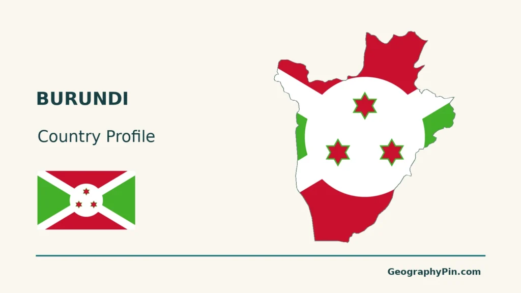
Map method: Original GeographyPin maps use public-domain Natural Earth countries 5.1.1 and rivers/lakes 5.0.0. The source national outline includes lake territory. Body maps show Lake Tanganyika as water and exclude it from terrain shading without denying territorial waters; no lake allocation boundary is drawn. Generalized lake polygons are not current-level surveys. The Ruvubu is extracted from the actual upstream portion of the source’s Kagera-labelled line, ending near its verified mouth reference; downstream Kagera and invented tributary connectors are excluded. GeoNames city and river coordinates are credited under CC BY 4.0. The highland-divide label is regional, not a surveyed watershed line or administrative boundary. Real Mapzen Terrain Tiles provide relief with Mapzen/USGS and upstream credits; no replacement heights are invented. WGS84 scales apply at their displayed latitude. The cover preserves the generalized territorial outline and uses the public-domain Commons Burundi flag rendition, with a separate complete flag for editorial identification.

