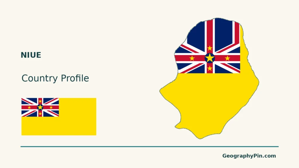
Niue’s cliffs and limestone interior do not match the familiar picture of a low coral ring around an open lagoon. Its raised land preserves an older atoll landscape, while its present-day country status involves a separate connection with New Zealand. Reading the physical island and the political relationship separately avoids two common misunderstandings.
Niue is a raised coral island in the South Pacific and a self-governing state in free association with New Zealand. Its limestone plateau preserves an uplifted atoll, including a former lagoon area now on land. Alofi is on the west coast; the island is not a modern ring of low islets around an open central lagoon.
How to use this article: Locate Alofi and Niue, read the raised landscape, or follow water below ground.
1. Locate Niue and Read Its Raised Landscape
Alofi and the South Pacific setting
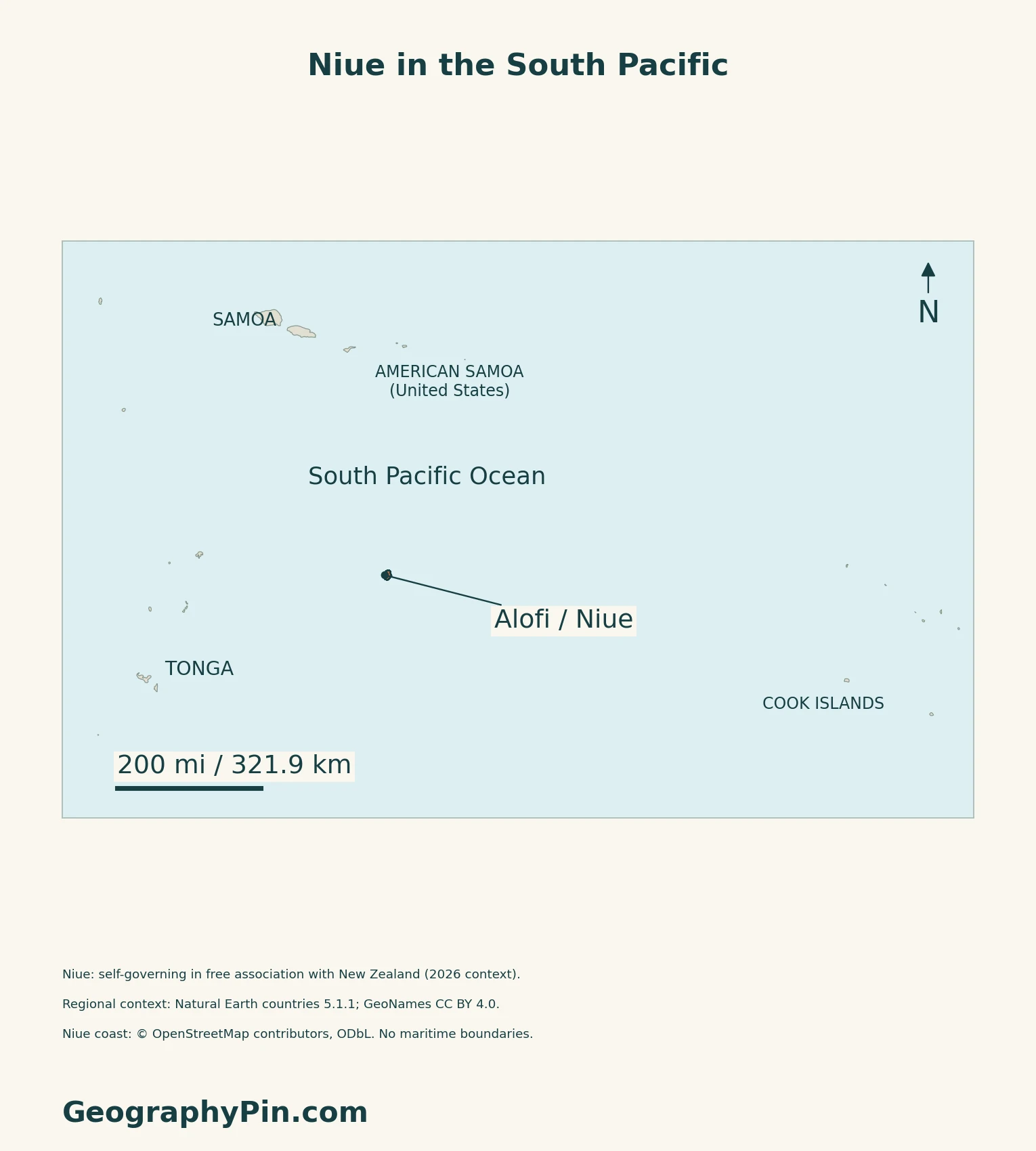
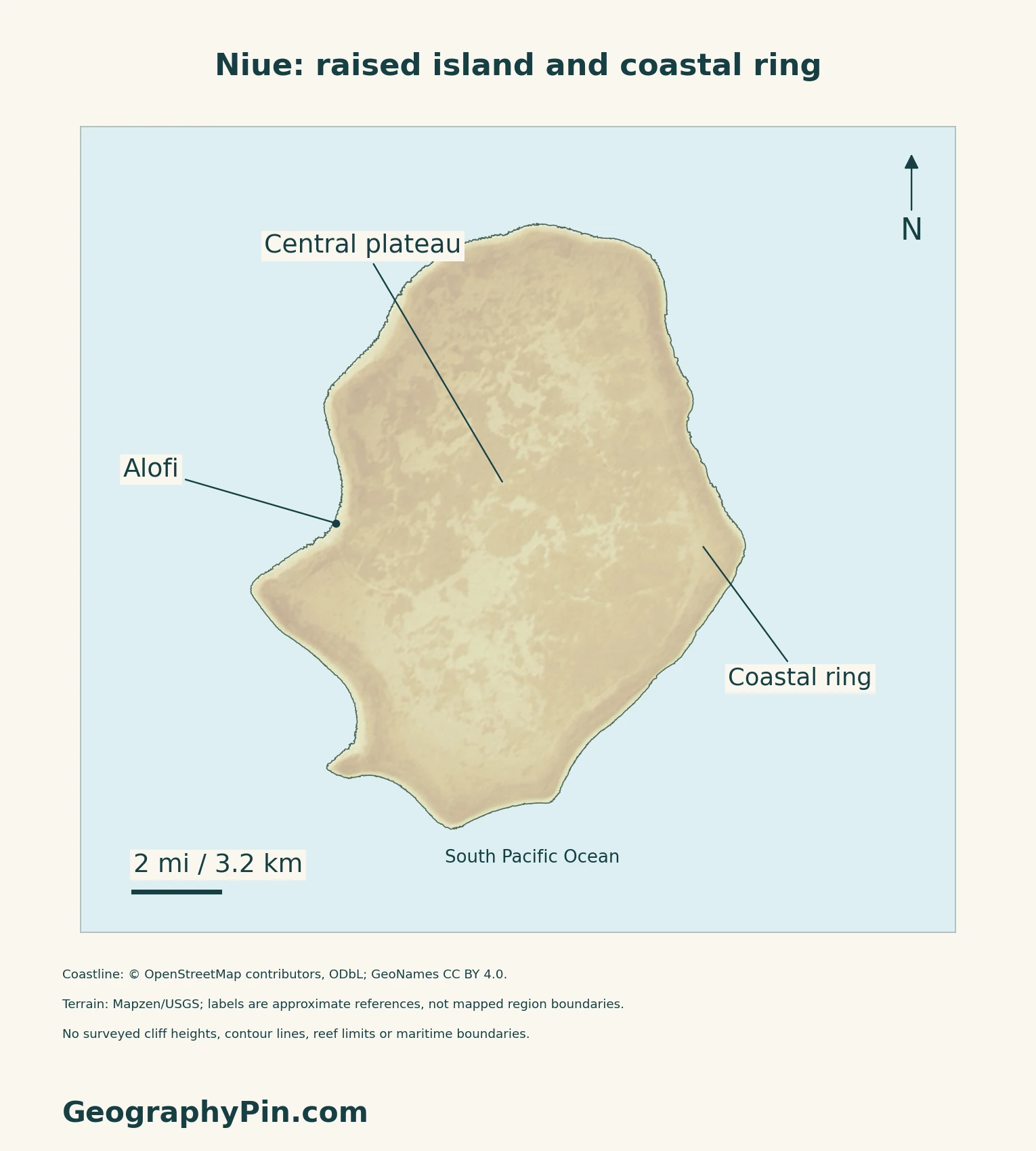
Niue’s capital, Alofi, is on the western side of the island. The locator map places Niue in its wider South Pacific setting; the detailed map instead focuses on the island’s coast and interior. Neither map is a maritime-boundary survey.
An old atoll above the sea
The International Union of Geological Sciences describes Niue as an uplifted coral atoll. Reef growth followed an earlier volcanic foundation, and later uplift raised the carbonate landform. The higher rim surrounds a former lagoon area, so “atoll” here describes a geological history rather than a present open lagoon.
Niue’s national biodiversity strategy describes a gently uneven central plateau, a lower terrace and a rugged coast. Cliffs, caves and wave-cut features are part of this limestone landscape. For the general formation process, the atoll explainer distinguishes reef systems, individual islands and lagoons.
| Feature | Geographic meaning |
|---|---|
| Central plateau | Raised limestone interior with gently uneven ground |
| Lower terrace and coast | A lower marginal setting with cliffs and wave-cut features |
| Former lagoon | A preserved part of the uplifted landform, not an open central body of seawater today |
2. Follow Rainfall Into the Limestone
Water below ground, not a river network
Niue does not have a normal surface network of rivers, streams and lakes. The Pacific Community’s ridge-to-reef programme explains that rainfall infiltrates the limestone and recharges underground freshwater. Groundwater supplies are supplemented by collected rainwater.
The important storage and flow are largely beneath the surface, where cracks and cavities connect the rock and groundwater.
The same permeability creates a management challenge: material discharged on land can reach the groundwater. Water-source protection therefore concerns what happens over the aquifer, not only the site where water is pumped. This does not establish current tap-water quality.
3. Separate Seasonal Climate From Current Weather
A warmer wet season and a cooler dry season
The 2022 Pacific climate assessment describes November–April as Niue’s warmer wet season and May–October as the cooler dry season. The South Pacific Convergence Zone influences that seasonal pattern.
Its Alofi–Hanan Airport station analysis found increasing annual and seasonal temperatures over 1951–2020, while rainfall trends showed little change. The historical trend does not eliminate year-to-year variability.
Tropical cyclones usually affect Niue between November and April. A cyclone passing through the exclusive economic zone is not necessarily a direct island landfall, so regional storm counts should not be read as local impacts. Current warnings, rather than a country profile, are the appropriate source for immediate weather decisions.
4. Check Dated Country Facts
| Item | Reference |
|---|---|
| Capital | Alofi |
| Census reference | 1,564 usual residents present on November 11, 2022; 1,681 people counted including visitors |
| Surface area | About 100 sq mi (260 km²), UNData’s 2023 surface-area reference |
| Languages | Vagahau Niue (Niuean) and English; both used in the census forms |
| Currency | New Zealand dollar (NZD) |
| Local reporting units | 14 villages in the 2022 census, including Alofi North and Alofi South |
| Status | Self-governing state in free association with New Zealand |
Who was counted?
The completed 2022 census report separates 1,564 usual residents present from 117 visitors. It also records 125 residents temporarily overseas; including them would give 1,689 residents. None of these figures counts the worldwide Niuean diaspora.
The census used a census-night, or de facto, count. People away from Niue were excluded from that count even when absent only briefly. These are dated census categories, not a current population estimate.
Free association, citizenship and UN membership
New Zealand’s foreign ministry describes Niue as a self-governing state in free association and part of the Realm of New Zealand. Niueans are New Zealand citizens. The relationship includes assistance with foreign affairs, defence and security when requested by Niue’s government, rather than making Niue an ordinary New Zealand local district.
Niue is not a United Nations member. UN DESA lists it separately among non-UN members and associate members of regional commissions. Citizenship, self-government and UN membership should therefore not be treated as interchangeable labels.
What Did We Learn Today?
Niue’s coral origin is visible in an uplifted landform, not a modern central lagoon; much of its fresh water is stored underground.
Sources & Data Notes
Sources, dates and map conventions
The completed 2022 census report is used rather than its preliminary release. Residents present, visitors and residents temporarily overseas are separate categories; no diaspora total or current population is inferred. Surface area follows UNData’s dated convention, not a maritime measurement. The language row documents bilingual census use, not an independently verified current statutory designation. Geological descriptions draw on the IUGS site assessment and Niue’s 2001 national biodiversity strategy. The latter is used for stable landforms, not its historical population, “most recent cyclone” statement or administrative conditions. Groundwater discussion uses the Pacific Community project overview, without reusing its undated population or water-quality claims. Climate statements refer to the 2022 assessment and its historical Alofi–Hanan Airport record, not current forecasts.
- Niue Statistics Office: completed 2022 census report, population scope and bilingual methods
- New Zealand MFAT: Niue free association, citizenship and currency
- UNData: Niue capital and 2023 surface-area convention
- UN DESA: Niue in the non-UN-member list
- IUGS geological heritage: Niue uplifted coral atoll
- Government of Niue: National Biodiversity Strategy and Action Plan, 2001, landforms
- Pacific Community ridge-to-reef programme: Niue groundwater
- Climate Change in the Pacific 2022: Niue chapter
Original maps use actual coastline ways from OpenStreetMap’s Niue extract via Geofabrik, downloaded November 17, 2026: © OpenStreetMap contributors, ODbL. This is not a shoreline survey date. Regional context uses public-domain Natural Earth countries 5.1.1; Alofi’s coordinate comes from GeoNames, CC BY 4.0. Mapzen/USGS terrain provides qualitative shading, not measured cliff heights, contours or current land cover. Forty-four negative source cells close to the coastline were omitted transparently, about 0.02% of the island mask; no replacement heights were drawn. Coastal-ring and plateau labels are approximate geographic references, not road alignments or mapped zone boundaries. The cover uses the same island coastline and a separate complete Flagpedia reusable flag rendition. The Niue Flag Act 1975 schedule corroborates the motif; 2:1 is the rendition’s ratio.